|
©The Archaeological Settlements of Turkey - TAY Project
|
|
|
|
|
|
Evliya Tepesi |
|
|
For site maps and drawings please click on the picture...  |
For photographs please click on the photo... 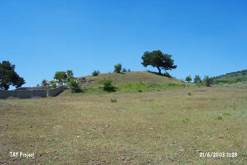 |
|
Type:
|
Mound |
|
Altitude:
|
1290 m |
|
Region:
|
Black Sea |
|
Province:
|
Ordu |
|
District:
|
Mesudiye |
|
Village:
|
Erikköy |
|
Investigation Method:
|
Survey |
|
Period:
|
|
|
|
|
 |
|
| The 70x90 m mound; 15 m high above the plain level; lies south-southwest of the city of Ordu; 500 m southwest of Erik village. It is in Evliya Tepesi Mevkii; some 1.2 km southwest of the village. To the east-northeast is the cemetery of Erik Village and to the southwest Tavuk Plateau. Discovered by M. Özsait in 1993; the site is slightly damaged by Yuyacak stream to the south. Many sherds and bifaced scrapers were found on the surface. According to Özsait; the majority of the finds belong to the EBA and a little amount date to the Late Chalcolithic Age. |
| Location: |
| Geography and Environment: |
| History: |
| Research and Excavation: |
| Stratigraphy: |
| Small Finds: |
| Remains: |
| Interpretation and Dating: |