|
©The Archaeological Settlements of Turkey - TAY Project
|
|
|
|
|
|
Esenköy Höyüktepe |
|
|
For site maps and drawings please click on the picture...  |
For photographs please click on the photo... 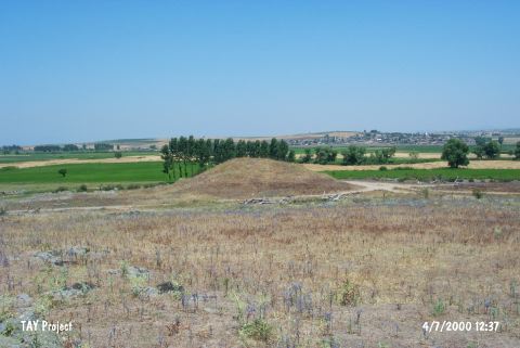 |
|
Type:
|
Habitation Site / Workshop |
|
Altitude:
|
42 m |
|
Region:
|
Marmara |
|
Province:
|
Balikesir |
|
District:
|
Manyas |
|
Village:
|
Esenköy |
|
Investigation Method:
|
Survey |
|
Period:
|
|
|
|
|
 |
|
| Location: This Balikesir site lies on and by a small tumulus 500 m northwest of the village of Esenköy; which is north of the city. Code H 9/2. |
| Geography and Environment: The low-lying Balikesir Plain and the mountains surrounding it formed tectonically. The alluvial deposits carried by the rivers leveled the rolling terrain. There are volcanic andesite rock-outcrops north of the undulating plains; which extend north of the city. |
| History: |
| Research and Excavation: The site was discovered by Mehmet Özdogan during his 1987 Balikesir survey. |
| Stratigraphy: |
| Small Finds: We lack information on the artifacts found. |
| Remains: |
| Interpretation and Dating: |