|
©The Archaeological Settlements of Turkey - TAY Project
|
|
|
|
|
|
Ersele |
|
|
For site maps and drawings please click on the picture...  |
For photographs please click on the photo... 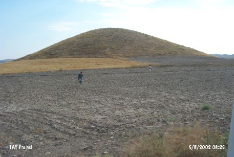 |
|
Type:
|
Mound |
|
Altitude:
|
1150 m |
|
Region:
|
Central Anatolia |
|
Province:
|
Aksaray |
|
District:
|
Ortaköy |
|
Village:
|
Ozancik |
|
Investigation Method:
|
Survey |
|
Period:
|
|
|
|
|
 |
|
| It lies in Ersele Mevkii; 2 km east of Ozancik Village; southeast of Ortaköy District; north-northeast of Aksaray Province. It was discovered by D.H. French. It was revisited by the Kaman Kaleköyük team during their 1996 survey. S. Omura includes it in the EBA settlements without providing any further detail. It takes place in the registered archaeological sites list prepared by Ministry of Culture and Tourism.The soil was taken from the east of the mound. The settlement was revisited during the surveys done to create the Aksaray Culture Inventory organized by the Aksaray Province Culture and Tourism Directorship in 2009. It is located at Çatin Village in Ortaköy District. The conical shaped mound is 125 m in diameter and 15-20 m in height. |
| Location: |
| Geography and Environment: |
| History: |
| Research and Excavation: |
| Stratigraphy: |
| Small Finds: |
| Remains: |
| Interpretation and Dating: |