|
©The Archaeological Settlements of Turkey - TAY Project
|
|
|
|
|
|
Cin Tepe 1 |
|
|
For site maps and drawings please click on the picture...  |
For photographs please click on the photo... 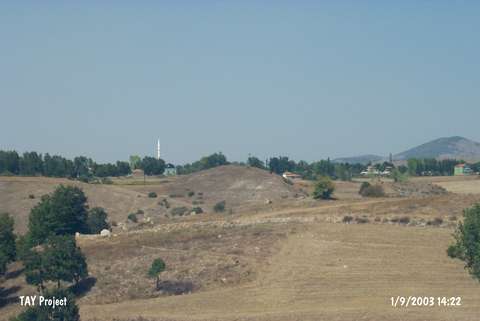 |
|
Type:
|
Mound |
|
Altitude:
|
840 m |
|
Region:
|
Black Sea |
|
Province:
|
Samsun |
|
District:
|
Havza |
|
Village:
|
Bekdigin |
|
Investigation Method:
|
Survey |
|
Period:
|
Early Iron Age Middle Iron Age Late Iron Age |
|
|
|
 |
|
| It lies within the borders of the Bekdigin Villagei northeast of the Havza District in Samsun. East of the mound flows the stream of Tersakan and to the north passes Ankara-Samsun motorway. It was discovered during the Survey in the Province of Samsun conducted by U.B. Alkim between 1971 and 1977. Sherds dating to the EBA, MBA, Iron Age, Roman and Late Roman Periods were collected from the surface. The site was observed and documented during TAYEx 2003 Black Sea-Eastern Anatolia region. It takes place in the registered archaeological sites list prepared by Ministry of Culture and Tourism. The mound appears in the Samsun Culture Inventory which was achieved after the surveys organized by the Samsun Special Provincial Administration Directorship of Development and Construction in 2009. It is about 100 m in diameter and 15 m in height. |
| Location: |
| Geography and Environment: |
| History: |
| Research and Excavation: |
| Stratigraphy: |
| Small Finds: |
| Remains: |
| Interpretation and Dating: |