|
©The Archaeological Settlements of Turkey - TAY Project
|
|
|
|
|
|
Yogunhasan Kalesi |
|
|
For site maps and drawings please click on the picture...  |
For photographs please click on the photo... 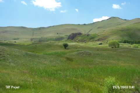 |
|
Type:
|
Slope Settlement |
|
Altitude:
|
1660 m |
|
Region:
|
Eastern Anatolia |
|
Province:
|
Kars |
|
District:
|
Sarikamis |
|
Village:
|
Karapinar |
|
Investigation Method:
|
Survey |
|
Period:
|
Middle Iron Age |
|
|
|
 |
|
| Location: It is situated at Altçayirlik Mevkii on the northern slope of the Kondol Hill, 3.6 km west of the Karapinar (Yogunhasan) Village, 40 km southwest of the Sarikamis Village in Kars. |
| Geography and Environment: The fortress is on the northern skirt of the Aras Güneyi Mountains, 1.5 km south of the Aras River. It is at the cross roads of historical trade routes from Caucasia strecthing into the Anatolia to cities such as Kars, Sarikamis, Horasan, Hasankale, Erzurum, Erzincan and Sivas, and from India, Afghanistan, Northwest Iran, Nakchivan, Igdir, and Kagizman. To the northwest is a water spring. In 1/25.000 scale maps, it appears as "Kale Tepe". |
| History: |
| Research and Excavation: It was discovered during the Survey of the Erzincan, Erzurum and Kars Provinces conducted by A. Ceylan of the Atatürk University in 2001, and then further investigated by a team accompanied by O. Belli. |
| Stratigraphy: Since the data obtained from the fortress belong to a survey, the exact stratification is not available. However, it appears that the fortress was founded during the Middle Bronze Age, and used intensely during the Middle Iron Age. |
| Small Finds: Architecture: It consists of a small fortress of 27x36 m in a rectangular plan where the wall foundations were formed into roughly dressed bedrock, a rock grave with a main hall and two chambers on the eastern section which ends with a steep cliff, and a reservoir about 350-400 m to the southwest of the fortress. The complex was dated to the Urartian period. The most important characteristic of the western and southern walls of the fortress is that they were built in the form of two terraces. In the west, the distance between the two terrace walls is 3.2-3.5 m while in the south, it is 4.5-5 m. Neither the western nor the southern terrace wall has a curtain wall or bastion. Instead of curtain walls and bastions which facilitate and reinforce the defence walls, they should have used the terrace walls. A 4 or 5 courses of the stones of the inner wall are extant. The mudbrick remains which collapsed and found in high heaps verify that the superstructure of the stone walls was of mudbrick. The exterior surfaces and joints of the large andesite stones used in the construction of walls were only roughly dressed. Pottery: The small jug with an egg-shaped body, two handles, short cylindrical neck, everted rim and polychrome paint decoration is an interesting find. It was decorated with animal, plant, and geometric motifs in red and black paint on a buff slip. A thick and horizontal red band was painted from the rim until the neck, and then water waves were painted in black paint. Below the water waves, between the horizontal red bands and the lower part was filled with adjacent hollow black motifs. Although the repeated animal figure between the plant motifs on the body is either a water bird or a cock, it is more likely to be a water bird. The body of the animal was completely painted in black, and the tail which was described with two wavy lines was left unpainted. Grave: The grave chamber can be descended from the fortress by steps carved into the bedrock, but some of the steps have been eroded and broken at present. It is almost impossible to reach to the grave chamber, which is 55-60 m high above the ground level, by climbing. An empty space of 2.7x2.5 m was left in the eastern section of the chamber. There are two rock steps that measure 1.8x0.2 m each to the east of this area. Both the rock steps and the square anterior space were elaborately carved out the rock mass. The grave chamber is accessed through a door of 1.6 m in height, 1.4 m in width, and 0.4 m in depth. There is a light opening of 0.5 m in depth, and 0.7x0.7 m in dimensions, 0.9 m above the door. The frame on the exterior surface of the light opening makes it look like a window from a distance. This entrance is similar to the entrance of the King Menua's grave at the citadel on the southern surface of the rock at the Van Fortress. The light opening above the door represents the second example within the expansion area of the Urartian Kingdom so far except the one at the Menua's grave. As the grave and environs of the door are blocked by a fill of stones and soil, it is uncertain it there is a door bearing. The main hall has a square plan, measuring 4.4x5 m in dimensions, and 3.2 m in average height. A single row of denticulated fascia on the upper part of the walls of the vaulted main hall encloses the entire chamber. There is a toal of 8 niches which have an average height of 1.4-1.5 m above the floor level; 4 on the western wall across the entrance, one each on the north and southern walls, and one on each side of the door. The niches have an average size of 0.7x0.7 m, and a depth of 0.55 m. The northern grave chamber can be accessed from the main hall through a door, which is 1.7 m high, 0.9 m wide, and 0.5 m deep. There is a crate (bed) of the dead. The southern grave chamber is accessed through a door, which is 2.2 m high, and 1.8 m wide. With a roughly rectangular plan, it is 2.3x2.8 m in dimensions, and 2.3 m in height. With two niches on the northern and two on the southern walls, there are a total of 4 niches in this grave chamber. As the fortress had been inhabited until the Middle Age, many of the architectural structures were destroyed. The elaborate and impressive appearance of the rock grave suggests it may have belonged to an important ruler. Other: The water of a roughly oval reservoir at an altitude of 1875 m is supplied mainly by a number of springs as well as snowfall and rainfall. At present, as a result of drastic landslides, and movement of the Mount Kondul toward the declining northern section, the shape of the pond has been altered and it is likely to be silted up. On the other hand, it still has a fairly good capacity of water reserves. Although the west portion of the wall survived to the present day, it has been partially covered up with soil. It is believed that the reservoir was built at the same time with the ruler's grave during the reign of King Menua. |
| Remains: |
| Interpretation and Dating: It seems that the Yogunhasan fortress, which was founded during the Middle Bronze Age, became a center of interest in the Iron Age during the early Urartian Kingdom Period. It probably functioned as a very significant administrative center, particularly during the military campaigns against the Land of Diauehi by King Menua. The fortress maintained its position during the reign of King Argishti I (786-764BC) for the military campaigns against the Land of Diauehi. However, due to lack of any recovery of cuneiforms in the vicinity, the original name of this administrative center during the Urartian Period is unknown. |