|
©The Archaeological Settlements of Turkey - TAY Project
|
|
|
|
|
|
Civek Tepe |
|
|
For site maps and drawings please click on the picture...  |
For photographs please click on the photo... 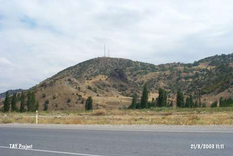 |
|
Type:
|
Mound |
|
Altitude:
|
680 m |
|
Region:
|
Black Sea |
|
Province:
|
Amasya |
|
District:
|
Merzifon |
|
Village:
|
Kayadüzü |
|
Investigation Method:
|
Survey |
|
Period:
|
Early Iron Age Middle Iron Age |
|
|
|
 |
|
| It lies 400 m north of the Samsun-Istanbul motorway, 2 km northeast of the Yeniceltek Quarter, 3 km east of the Kayadüzü Town in the Merzifon District of Amasya. It is also known as Karakaya Mevkii. The settlement is 120 m high above the plain level, presently measuring 15 x 20 m in dimensions with an appearance of a fortified fortress. The destroyed sections of the hill yielded limited number of sherds from the Early Bronze Age and Iron Age settlements. The Iron Age sherds are specifically from the Early and Middle Iron Ages, limited in number. |
| Location: |
| Geography and Environment: |
| History: |
| Research and Excavation: |
| Stratigraphy: |
| Small Finds: |
| Remains: |
| Interpretation and Dating: |