|
©The Archaeological Settlements of Turkey - TAY Project
|
|
|
|
|
|
Yukari Yarimca |
|
|
For site maps and drawings please click on the picture...  |
For photographs please click on the photo... 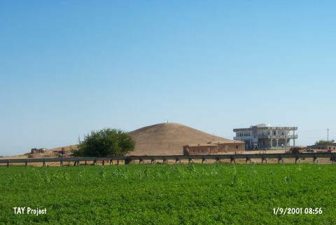 |
|
Type:
|
Mound |
|
Altitude:
|
370 m |
|
Region:
|
Southeastern Anatolia |
|
Province:
|
Sanliurfa |
|
District:
|
Harran |
|
Village:
|
Yukari Yarimca |
|
Investigation Method:
|
Survey |
|
Period:
|
|
|
|
|
 |
|
| It is situated 4 km east of the Sanliurfa-Akçakale motorway, 8.5 km northwest of Harran. It has a base diameter of 240 m and a circular form. It is a very steep mound, rising with a smooth inclination. The eastern and southern skirts have been occupied by a village settlement. It is 25 m high above the plain level. It has been heavily destroyed by erosion due to precipitation. Following periods were identified: -Chalcolithic Age (straw tempered plain ware, body fragments) -Early Bronze Age (metallic fine ware, reserved slip decorated painted triangular handled, burnished plain ware) -Roman Period (fine ware with red and beige paste ) -Medieval-Islamic Period (green, beige paste, plain ware, body fragments) [Yardimci 2004:136, 164-165]. It takes place in the registered archaeological sites list prepared by Ministry of Culture and Tourism. |
| Location: |
| Geography and Environment: |
| History: |
| Research and Excavation: |
| Stratigraphy: |
| Small Finds: |
| Remains: |
| Interpretation and Dating: |