|
©The Archaeological Settlements of Turkey - TAY Project
|
|
|
|
|
|
Yazihüyük |
|
|
For site maps and drawings please click on the picture...  |
For photographs please click on the photo... 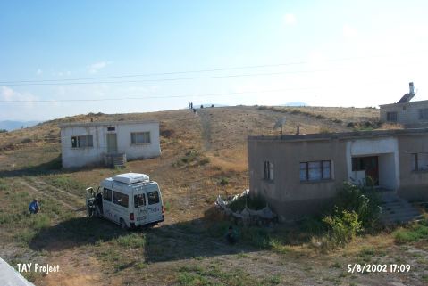 |
|
Type:
|
Mound |
|
Altitude:
|
1330 m |
|
Region:
|
Central Anatolia |
|
Province:
|
Nevsehir |
|
District:
|
Derinkuyu |
|
Village:
|
Yazihüyük |
|
Investigation Method:
|
Survey |
|
Period:
|
|
|
|
|
 |
|
| There are village houses on the skirts and around the mound, which remained within the Yazihüyük Town, west-southwest of the Derinkuyu District of Nevsehir. It composes of two terraces that extend in east-west direction. The first terrace is 7 m high, and 135 m long in east-west direction; and the second terrace is 12 m high, and 95 m long in east-west direction. Obsidian flake or core fragments were often found on the surface in addition the Chalcolithic Age, EBA, MBA, Iron Age, Hellenistic, Roman, Byzantine Period sherds. It is listed among the registered archaeological sites by the Ministry of Culture and Tourism. |
| Location: |
| Geography and Environment: |
| History: |
| Research and Excavation: |
| Stratigraphy: |
| Small Finds: |
| Remains: |
| Interpretation and Dating: |