|
©The Archaeological Settlements of Turkey - TAY Project
|
|
|
|
|
|
Elemenli Höyük |
|
|
For site maps and drawings please click on the picture...  |
For photographs please click on the photo... 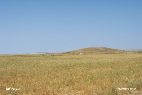 |
|
Type:
|
Mound |
|
Altitude:
|
935 m |
|
Region:
|
Central Anatolia |
|
Province:
|
Ankara |
|
District:
|
Sereflikoçhisar |
|
Village:
|
Hamzali |
|
Investigation Method:
|
Survey |
|
Period:
|
Early |
|
|
|
 |
|
| The mound; discovered by I. Todd in 1965; lies near the shore of Tuz Gölü; 4 km northwest of Hamzali Village; 10 km southwest of Sereflikoçhisar District of Ankara Province. 3 km northwest of the mound passes Sereflikoçhisar-Aksaray motorway. The site is one of the Early Chalcolithic Age settlements of Konya Plain and is dated to the 7th phase in ASPRO. It was researched during the survey by S. Omura in 2003. The dimensions of the mound are: 270 m in north-south direction, 300 m in east-west direction, it is 11 m high. [Omura 2008:213; 217]. It takes place in the registered archaeological sites list prepared by Ministry of Culture and Tourism. |
| Location: |
| Geography and Environment: |
| History: |
| Research and Excavation: |
| Stratigraphy: |
| Small Finds: |
| Remains: |
| Interpretation and Dating: |