|
©The Archaeological Settlements of Turkey - TAY Project
|
|
|
|
|
|
Samsat |
|
|
For site maps and drawings please click on the picture... 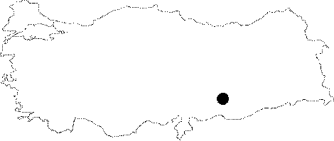 |
For photographs please click on the photo...  |
|
Type:
|
Mound |
|
Altitude:
|
425 m |
|
Region:
|
Southeastern Anatolia |
|
Province:
|
Adiyaman |
|
District:
|
Samsat |
|
Village:
|
Samsat |
|
Investigation Method:
|
Excavation |
|
Period:
|
New Assyrian Empire Period |
|
|
|
 |
|
| Location: The site; previous to its inundation by Atatürk Dam; used to lie in Adiyaman; Samsat District; just northeast of the center of the district. It survived as an island for a while after the formation of the dam's water reservoir since it was quite a high mound. The location code is T 51 / 14. |
| Geography and Environment: The mound founded as a settlement on Euphrates' bank; became an inland settlement; 700 m away from the river as a result of the geological oscillations in the river bed; previous to the inundation. The 37-40 m high mound consists of a large mound cone; surrounding terraces; and a lower city; it measures 500x350 m at the base. The mound gets very steep at the east and is sloped at the southwest. It stands upon an elevation of pebble fill as is observed in the sections seeing the river. The east terrace; where the Chalcolithic Age assemblage; is distributed intensely is thought to be the earliest mound. The settlement; known by the names of Samosate; Samosatum; then Semisat and Sumaisat in the Classical Ages; is located at the broadest section of the coastal plain and is therefore at the most advantageous point for crossing over the river. There are numerous fresh water springs at the relatively smooth slopes joining the plain with the plateau. Samsat is a considerable site with such geographical properties; settled in all ages since prehistory until recently. |
| History: |
| Research and Excavation: It was visited by many scientists such as Moltke, Ainsworth, Humann and Puchstein. In 1935, Jacopi saw the city, and published one inscription. The first comprehensive survey was conducted by K. Dörner and R. Naumann in 1938. The initial excavation was performed in 1964 under the direction of T. Goell because Samsat was going to be inundated due to the construction plan of a dam at Halfeti over the Euphrates River by the State Hydraulic Works with a reservoir reaching all the way to Gerber [Serdaroglu 1977:21]. Approximately 10 years after this excavation, it was surveyed accompanied with surface collection by Ü. Serdaroglu in 1975, and by M. Özdogan in 1977 as part of the Lower Euphrates Project carried under the GAP Project in order to save the artifacts to be flooded under the reservoir waters of the Karakaya and Atatürk dams. These surveys indicated that it had been uninterruptedly inhabited from the Halaf Period until the Ottoman Period. Excavations were resumed in 1978 by METU as part of the Lower Euphrates Area Salvage Project. The excavations between 1978 and 1987 under the direction of N. Özgüç mainly focused on recovery of the late periods until the site became flooded. |
| Stratigraphy: The earliest period identified at Samsat is the Early Halaf Period, followed by the Ubaid culture. Besides the sherds collected during the surveys, some cultural deposits were identified although the excavations conducted under the direction of N. Özgüç in a narrow area with a 5 m deep sounding below the fresh water spring to the east of the mound failed to yield any architectural remains [Özgüç (N) 1988:294]. The Uruk Period which was excavated in a broader area was superimposed by the Early Bronze Age, Middle and Late Bronze Ages, Iron Age, Classical Period and Post-Classical Period settlements. Samsat was the center of the Late Hittite Kingdom of Kummuh during the Iron Age, and it was taken over by the Urartu Kingdom, and then became a province of the Assyrian Confederation. Being dominated by Medes and Persians for a while, the city became part of the Alexander's Empire. After becoming capital of the Commagene Kingdom, it became a subsidiary of Rome as a province of the Roman Empire. Afterwards it was conquered many times by the Byzantine and Arabs, followed by becoming the capital of a Turkoman Beylik, a Crusader County, an independent Armenian County, an Artuqid and an Ayyubid city, and then became an Ottoman city in the 14th century BC. The excavations at Samsat Höyük mainly focused on the central section on which the Commagene Kings' palace was founded, in the Southwest Quarry, on the east slope of the hill, inside the pit in the Samsat District, on the outer walls and in the Lower City. Since a few levels were destroyed through leveling for the Middle Age wall and preparation of the compressed soil at the East Quarry I, sherds and small artifacts dating to the Byzantine, Roman, and Hellenistic Periods, Iron Age and 2nd Millennium BC were uncovered independent from the levels they belong to [Özgüç 1986:221]. Although uncertain, stratification of the mound cone and the settlements in the lower city can be listed as follows: Levels/building level I-III: Medieval Age (plan squares t-u/9-10) Level IV: Roman Period Levels V-VI: Early and Late Hellenistic Period (4th century BC) Level VII: Neo-Babylonian Period (6th century BC) Levels VIII-XI: Iron Age (plan squares d-f/15-18) Levels XII-XIII: Late Bronze Age-Mid Bronze Age Level XIV: Assyrian Colonial Age 18th century BC Level XV: 19th century BC Levels XVI-XIX: Early Bronze Age Level XX: Late Chalcolithic Age to Early Bronze Age transition period Levels/building level XXI-XXVII: Chalcolithic Age (plan squares g-r/14-15) It appears that Samsat Höyük was subject to large settlements during the Chalcolithic Age and Early Bronze Age. The settlements decreased in size during the 2nd Millenium BC compared to other periods. During the Iron Age, it appears to be a very large settlement expanding over the limits of the hill cone. The ancient name was Samosate/Samosatum. Although uncertain, it can be proposed that the name of the city during the EBA might have been similar. |
| Small Finds: Architecture: The Lower City was enclosed by strong walls. The visible remains exceed over 3 km in length. Based on the height of the walls reaching up to a height of 5 m at certain spots, a second set of walls was added following the expansion of the city in north-south direction. These walls have been mostly destroyed on the southern end in the area where the Samsat settlement is located at. Only the section still known as the Urfa Gate by the locals that opens into the bank of the Euphrates has been preserved. The room which was uncovered level VIII was entirely cleaned and its communication with the other rooms of the building was clearly identified. It is a bathroom accessible by a flight of two steps. The floor made of two layers of bricks and the plinth consisting of upright bricks have been well preserved. Not all of the rooms with good masonry where a few courses of bricks were preserved at some sections with stone foundations in the section facing the south was uncovered. Two large silos plastered inside at level VII cut through these rooms in the center. On the west side of the quarry, there is a podium with a projection of four corners. The most interesting find of this level is a bronze grasshopper figurine inside an Assyrian vase [Özgüç 1986:222-223]. The excavations in the Southwest Quarry yielded fragments of Level IX walls with stone foundations and a somewhat long room on the southern end of the quarry. Pottery: It seems that the same type of ceramics were consistently used throughout the Iron Age. It is coarse straw tempered ware with simple and various tones of buff color. Examples of such ceramics are limited in number [Özgüç 1986:223]. Seal: Cylindrical seals belonging to the Neo-Assyrian and Neo-Babylonian Periods were unearthed in the Iron Age levels VII-X of Samsat. Presence of a scene which depicts worshipping the Moon God in a boat on one of the qualified cylindrical seals was reported [Mellink 1988:110]. A seal from the Neo-Babylonian Period was recovered from the East Quarry II. Recovered in a room with a mixture of Islamic, Roman and Hellenistic Period materials, the seal should have moved to the upper stories in a way. It represents the second of such artifacts belonging to the Neo-Babylonian Period (625-539 BC) at Samsat. One face of the seal depicts popular motifs of the time and a figure worshipping against several God figures [Özgüç 1986:222]. A cylindric seal made of red-brown chalcedony with white veins uncovered at level IX is particularly important among others. The scene on the seal depicts a king worshipping a figure, probably representing the Moon God of Harran, holding a crescent in his left hand, and an omega sign in his right hand on a podium in a boat. |
| Remains: |
| Interpretation and Dating: It is believed that the seal probably belonging to the the late phase of Late Assyrian art or Sargon II period (721-705BC) uncovered at level IX may constitute a basis for approximate dating of the levels in the Southwest Quarry. Thus, the levels VIII and VII should correspond to the Assyrian hegemony and the Neo-Babylonian Period that ruled for 100 years following Sargon. The levels IX and X should have belonged to the second half of the 9th century BC and 8th century BC when Kummuh was under the Assyrian protection [Özgüç (N) 1986:223]. |