|
©The Archaeological Settlements of Turkey - TAY Project
|
|
|
|
|
|
Pendik - Temenye |
|
|
For site maps and drawings please click on the picture...  |
For photographs please click on the photo... 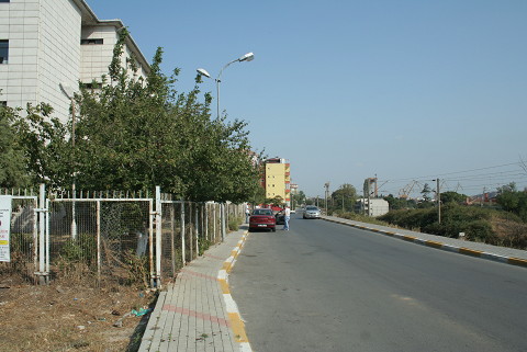 |
|
Type:
|
Mound |
|
Altitude:
|
50 m |
|
Region:
|
Marmara |
|
Province:
|
Istanbul |
|
District:
|
Pendik |
|
Village:
|
|
|
Investigation Method:
|
Excavation |
|
Period:
|
|
|
|
|
 |
|
| It has been obscured by the gardens of the present Borusan Factory and SSK Hospital between the Pendik and Kaynarca railway stations, approximately 1.5 km east of Pendik. It is an oval and very flat mound. Although it was introduced as Pendik Höyük in archaeological literature, it is better to refer to it as Temenye Höyük. It measures ca. 170x280 m in dimensions with a height of at least 2 m in the railway cleavage. It was first introduced in 1908 by Miliopulos while the surface finds which were sent to the Swedish National Museum in Stockholm were published by Arne [Arne 1922:122-128]. They were re-published in detail by Janse in 1925 [Janse 1925:166-171]. The first systematic excavation conducted as a sounding on the mound was performed under the direction of S. A. Kansu in 1961 in four spots of the railway cleavage. Further excavations were performed under the direction of the experts from the Istanbul Archaeological Museums in 1981 and 1992 [Pasinli et al. 1994:147-163]. The 1981 campaign yielded a 20 cm thick layer of mixed Classical and Byzantine Period sherds in the uppermost level, followed by a 60 to 80 cm thick Byzantine Period level, and a Late Neolithic Age level with a total of 6 phases. The 1992 campaign confirmed presence of the uppermost Classical Period level underlied by a demolished level probably due to severe erosion with only a few remains and graves, followed by a stratification consisting of 3 or 6 building phases within a single cultural deposit [Pasinli et al. 1994:152]. It takes place in the registered archaeological sites list prepared by Ministry of Culture and Tourism. |
| Location: The site is located in the Istanbul Province; 1.5 km east of Pendik; once a village; now a district of the city of Istanbul. The mound lies between the Pendik and Kaynarca train stations; 1;450 m from Pendik Train Station and 550 m from Kaynarca Train Station. It is now beneath the gardens of the Borusan Factory and the SSK Hospital. It is possible to reach the mound by walking from the train stations or by taking the turn off to the road leading to the SSK Hospital from the Pendik-Kaynarca highway. |
| Geography and Environment: The site lies on the shore of the Marmara Sea; northwest of a small bay that lies east of the point of the Temenye Peninsula. East of the site are two springs as well as a dried stream bed. The stream must have flowed by the site in the Neolithic. The mound is protected from harsh northern winds by the hills (Göztepe and Tavsantepe) to its north. It is broad and oval in shape and 170x280 m in size. Although the site has been named Pendik Höyük after the closest village; the name Temenye Höyük is more correct. The Pendik/Temenye mound has been divided into two by the old train tracks. The press called the mound "The mound with a train going through it". From the cross-sectional profile exposed by the train tracks; the height of the mound appears to be at least 2 m. Another profile was created after the foundation of the SSK Hospital was dug. The construction of the Borusan Factory further destroyed especially the southwestern side of the site. Recently; as the city of Istanbul grew; the remaining parts of the mound became completely destroyed. On the site there are now cooperative housing structures; and more hospital buildings. The only areas where excavation could now be conducted are the Borusan Factory football fields and another area in the western part of the site. |
| History: |
| Research and Excavation: |
| Stratigraphy: |
| Small Finds: |
| Remains: |
| Interpretation and Dating: |