|
©The Archaeological Settlements of Turkey - TAY Project
|
|
|
|
|
|
Mercin / Boz Höyük |
|
|
For site maps and drawings please click on the picture...  |
For photographs please click on the photo... 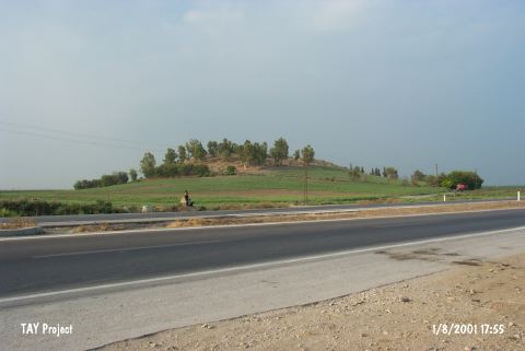 |
|
Type:
|
Mound |
|
Altitude:
|
90 m |
|
Region:
|
Mediterranean |
|
Province:
|
Adana |
|
District:
|
Ceyhan |
|
Village:
|
Incetarla |
|
Investigation Method:
|
Survey |
|
Period:
|
|
|
|
|
 |
|
| It is situated on the old Ceyhan-Kadirli motorway, 3 km north-northwest of the Ceyhan District, east of the provincila center of Adana. It lies to the southwest of the Incetarla (Mercin) Village, and northeast of the Ceyhan River. It is also known as Bozhöyük, it has a base diameter of 160 m, and a height of 20 m with a flat top. It was investigated during the Neilsen Expedition in 1936. Sherds dating from the 2nd Millennium BC until the Roman Period were found on the hillop [Seton-Williams 1954:131-163; findspot 9]. It takes place in the registered archaeological sites list prepared by Ministry of Culture and Tourism. |
| Location: |
| Geography and Environment: |
| History: |
| Research and Excavation: |
| Stratigraphy: |
| Small Finds: |
| Remains: |
| Interpretation and Dating: |