|
©The Archaeological Settlements of Turkey - TAY Project
|
|
|
|
|
|
Lidar Höyük |
|
|
For site maps and drawings please click on the picture... 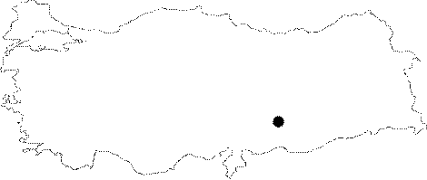 |
For photographs please click on the photo...  |
|
Type:
|
Mound |
|
Altitude:
|
448 m |
|
Region:
|
Southeastern Anatolia |
|
Province:
|
Sanliurfa |
|
District:
|
Bozova |
|
Village:
|
Dikili |
|
Investigation Method:
|
Excavation |
|
Period:
|
|
|
|
|
 |
|
| . |
| Location: The mound is located northwest of Sanliurfa; just southwest of the village of Lidar 23 km north of the district of Bozova. The site is partially occupied by the modern village and since it was on Euphrates' bank it is today inundated by Atatürk Dam. The location code of the site is T 51 / 40. |
| Geography and Environment: The 200x240 m mound is 25 m high from the plain it is on. It is quite a large site together with its cone and its northeast and southwest terraces. There is a 100x110 m plain area on the top of the mound following the rather steep slopes. It was probably a preferable site to settle since at this location; it is possible to cross over the Euphrates. It may be assumed that the site; together with Gritille right across it; was controlling this essential route. |
| History: |
| Research and Excavation: Lidar Höyük was discovered in 1977 while conducting the Lower Euphrates Basin Project. It was excavated from 1979 until the year it was flooded by the reservoir waters of the Atatürk Dam (1987) under the direction of H. Hauptmann on behalf of the German Archeological Institute and University of Heidelberg. Lasting for 9 campaigns, these excavations mainly focused on the upper strata. It takes place in the registered archaeological sites list prepared by Ministry of Culture and Tourism. |
| Stratigraphy: The surveys yielded finds dating to the Chalcolithic Age, Early Bronze Age, Middle-Late Bronze Age, 2nd Millennium BC, Iron Age, Classical Age and after [Özdogan 1977:162-163]. On the other hand, according to the reports of H. Hauptmann, the stepped trench opened on the northern section of the settlement yielded an uninterrupted stratification of ca. 30 m extending from the mid-Early Bronze Age until the Middle Age [Mellink 1987:8; Hauptmann 2004:108]. The surface finds indicate that the site extends dates back to the Aceramic Neolithic Age. The transition to the Early Iron Age was uninterrupted. It was a village settlement during that period [Hauptmann 2004:108]. With the Persian Period, reoccupation started [Mellink 1987:8]. Lidar Höyük was uninterruptedly occupied from the mid Early Bronze Age till the Middle Age, the 13th century BC [Hauptmann 2004:108]. |
| Small Finds: Architecture: The levels 6a-d include streets and domestic units belonging to the Persian Period. Pottery: The grooved vessels well-known from the early phase of the Early Iron Age of the Upper Euphrates were also found here [Hauptmann 2004:108]. Buff-coloured carinated bowls and trefoil jugs are also of Iron Age ware. The pottery of the 6th century BC mainly bear local characteristics. Figurine: Terracotta figures of Persian riders were uncovered. Relief: Astarte reliefs were found. Metal: Triangular fibulae of Persians are among the typical Iron Age finds at Lidar [Mellink 1985:554-555]. |
| Remains: |
| Interpretation and Dating: It appears that as one of the largest and the most important mounds of the region, Lidar had been occupied starting from the Late Chalcolithic Age. Lidar Höyük came into prominence during the Early Bronze Age and particularly during the 2nd Millennium BC. However, it is not possible to make any interpretation for the Iron Age of Lidar Höyük. Developed and flourished during the Classical Age, the site should have been identified with the city of Seleucia, known to have been founded across Samsat (Samosota) during the Roman Period. It is known that Seleucia became subject to Samsat after a while. According to the surface finds, Lidar lost its significance during the Middle Age, and the site was either reduced in size or moved outside the mound area just like the modern village [Özdogan 1977:163]. |