|
©The Archaeological Settlements of Turkey - TAY Project
|
|
|
|
|
|
Kültepe / Karahöyük |
|
|
For site maps and drawings please click on the picture... 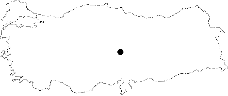 |
For photographs please click on the photo...  |
|
Type:
|
Mound |
|
Altitude:
|
1017 m |
|
Region:
|
Central Anatolia |
|
Province:
|
Kayseri |
|
District:
|
Merkez |
|
Village:
|
Karaev |
|
Investigation Method:
|
Excavation |
|
Period:
|
|
|
|
|
 |
|
| Location: It lies immediate south of the Karaev or Karahöyük/Karhöyük (recent name; Kültepe) Village of the Merkez District; about 20-21 km northeast of the Kayseri Province. It is recorded as Kültepe in the archaeological literature as it looks ash-coloured from a distance; but it is locally known as Karahöyük. Therefore; it is better to cite it with the both names given as Kültepe-Karahöyük. It should also be preferred in order not to confuse it with the other mounds called Kültepe in Anatolia. |
| Geography and Environment: It is located on a slightly depressed area in the northeast of the Kayseri Plain on a plateau road connecting Kayseri to Sivas. Dish-shaped plain; probably; played an important role in choosing this site for occupation. Wells were used by inhabitants because of the water table is very near the surface. The nearest water resource is a fresh water spring; 600 m far. The mound; in the form of a round hill; measures 20 m in height and 450x550 m in dimensions; except the karum area [Özgüç 1950:11]. It has been severely damaged due to several reasons since the end of 19th century. This damage was stopped only by the excavations conducted by T. Özgüç. The area is being protected by wire fences. |
| History: |
| Research and Excavation: It was introduced with the discovery of the Colony Period tablets in 1882 by Th.G. Pinches, and excavated in 1893-94 under the direction of E. Chantre in order to uncover these tablets, followed by excavations conducted in 1906 by H. Winckler and within the same year by H. Grothe. In 1925, the mound attracted more attention in terms of Anatolian archaeology when B. Hrozny succeeded to reach to the tablets, although small in numbers, in a trench of 52x32 m and in small soundings in an area which was later called the Karum. The elevation on the hilltop was partly excavated during these excavations, which were taken over by the Turkish archaeologists under the direction of T. Özgüç in 1948. Özgüç initially focused only in the Karum area, then started excavations in the mound section. The excavations being still ongoing have also partly shed light on the Early Bronze Age settlements other than the Colony Period. It is listed among the registered archaeological sites by the Ministry of Culture and Tourism. The excavations are being led by F. Kulakoglu since 2006. |
| Stratigraphy: The excavations revealed that the site had been inhabited from the early 3rd Millennium BC until the Roman Period. Among these settlements, the most significant one is the city settlement referred by written sources with its name (Kanes) known during the Assyrian Colony Period [Özgüç 1999:4]. The stratification of the mound is as follows from earliest to latest: Building level 18 (mound): Early Bronze Age I Building levels 17-14: Early Bronze Age II Building levels 13-11: Early Bronze Age III Building levels 10-9/Karum 3-4: transition from Early Bronze Age III to Middle Bronze Age Building level 8/Karum 2: Assyrian Colony Period Building level 7/Karum 1b: Assyrian Colony Period Building levels 6-5/Karum 1a: Assyrian Colony and Hittite Periods Building levels 4-3: Iron Age Building levels 2-1: Hellenistic and Roman Periods |
| Small Finds: Architecture: At Kültepe, the Iron Age is represented by the building level 3, which was overlaid by remains from the Hellenistic and Roman Periods extending onto a wide terrain. The former city of Kanes was again an important center during that age as a city of the Tabal territory. However, the damage from the Roman and Hellenistic Period structures and removal of stones by the villagers resulted in a heavy destruction of the Iron Age settlement. The fact that the Iron Age structures were built somewhat weaker than earlier periods may have facilitated the destruction. Fragments of orthostats with reliefs, which were uncovered as scattered or thrown around among the deposits of later periods indicate presence of large structures which were built in accordance with the conventional Anatolian traditions at Kanes. Kültepe lost its signifance following the Assyrian Trade Colonies Period, but it seems that it was intensely inhabited during the first and second building phases of the Iron Age. Observed in a single level on some sections of the hill while in two levels in other sections, the thickness of the deposit is 2.15 m. The remains from this age overlay deposits of the latest phase from the Assyrian Trade Colonies. Typical Iron Age pottery was found in sections with no architectural remains. Two building levels were identified at aa-dd/48-49 while there was only one building level at nn-oo/13-15. The structures of the latest building level at aa-dd/48-49 have not been well-preserved (Pic. 1). A domestic structure with a rectangular plan and 4 small rooms (!) was exposed here. The structure extends to the west of the excavation area. The stone walls of the single-room structure lying to the southeast of this structure reach up to 1.4 m. And, it belongs to the second, i.e. earlier building level. The walls are narrower than the upper level. The small room has a trapezoid shape, built only with stones. The corners of the rooms are not edged. The floor and walls of both structures were elaborately and thickly plastered with mud. Traces of fire and ash layers indicate a severe destruction of the structure belonging to the latest building level by fire. These small domestic structures were built only with stones, as in the modern Karahöyük village houses, and the construction material was mainly soft andesitic rock. The rough floors are of compressed soil. The single-room structure at N/39-40 is from the latest building phase. Small and large, irregular stones were used for walls. The room was furnished with three benches along the three walls. The inner dimensions of the room measure 4.5x4.5 m, i.e. it is square in plan. The structure has two construction phases. The stones of the second/later phase wall are very large compared to the earlier phase. It was constructed over the debris of an underlying earlier structure from the same age, i.e. Iron Age. The foundations of this earlier structure at N/39-40 were built with small stones. The wall fragments of three separate structures found at wall depths of 0.09 m, 10.3 m and 9.95 m in the area O-P/38-39 belong to the earlier underlying building level. Furthermore, the small wall fragment at P/39 may have belonged to the earlier phase of the second building level. Only the western portion of the structure at O/39-40 was exposed. The four-step stone stairs of this house was well-preserved. The larger walls were built with regular stones. The bases made of regular stones of the wooden poles supporting the roof lies down on the floor. At the bottom of the northern wall of the room are two tandoors full of ashes. Two rooms of the rectangular structure at nn-oo/13-15 have been well preserved. The room measuring 9x7.5 m in dimensions has a L-shape. The door of the smaller room measuring 4.8x4 m in dimensions faces west. The small division (1.8x0.8 m) on the northwestern corner outside the house should have been the staircase pedestal. The stone walls have been preserved up to a height of 1 m from the floor. The well-dressed stones on the walls were gathered from earlier buildings. Both domestic structures belong to the earlier building level of the Iron Age. There is no later building level here. It seems that the first building level at Kültepe had two phases based on the presence of walls in fragments. However, extent of the destruction didn't allow investigation of these phases in detail. However, ceramics found among the debris of the late phase, particularly kraters with depictions of deers suggest that this phase may have been parallel to the levels 4 cM and 4 bM at Alisar. Thus, it is believed that the first and late phases lasted from the mid-9th century BC to the mid-7th century BC. The remains of the late building level are dated to the late 7th century BC and the first half of the 6th century BC. None of the two building levels revealed any documents indicating that Kültepe was a political and cultural center. As mentioned above, no monumental palaces and temples decorated with reliefs were uncovered at Kültepe. No special artwork was found except painted ware. However, it is still believed that there were important buildings at Kanes during that age. Yet, fragments of basalt orthostats in relief indicate presence of large buildings at Kültepe, as their walls being decorated with stone slabs in relief. |
| Remains: |
| Interpretation and Dating: |