|
©The Archaeological Settlements of Turkey - TAY Project
|
|
|
|
|
|
Kizilözün |
|
|
For site maps and drawings please click on the picture...  |
For photographs please click on the photo... 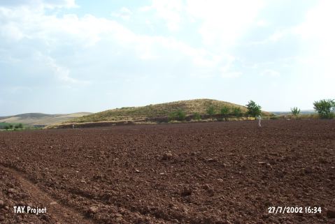 |
|
Type:
|
Mound |
|
Altitude:
|
955 m |
|
Region:
|
Central Anatolia |
|
Province:
|
Nevsehir |
|
District:
|
Avanos |
|
Village:
|
|
|
Investigation Method:
|
Survey |
|
Period:
|
|
|
|
|
 |
|
| It is situated at Hüyükbükü Mevkii, 11.8 km northwest of the Gülsehir District, north of Nevsehir Province. With a height of 20 m, and dimensions of 300x250 m, it is one of the largest mounds in the region. It lies on the northern bank of the Kizilirmak River to the immediate south of the Avanos-Gülsehir motorway. S.Y. Senyurt who discovered the settlement in 1997 reports presence of the EBA, MBA-LBA, Iron Age and Hellenistic-Roman Period sherds among others collected from the southern section disturbed with many pits. |
| Location: |
| Geography and Environment: |
| History: |
| Research and Excavation: |
| Stratigraphy: |
| Small Finds: |
| Remains: |
| Interpretation and Dating: |