|
©The Archaeological Settlements of Turkey - TAY Project
|
|
|
|
|
|
Kizçiftligi / Trikopi Çiftlik |
|
|
For site maps and drawings please click on the picture... 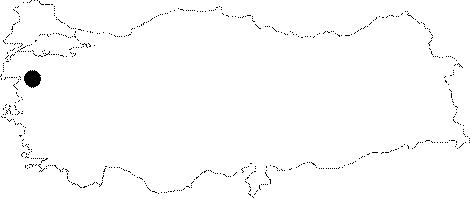 |
For photographs please click on the photo... 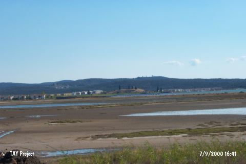 |
|
Type:
|
Mound |
|
Altitude:
|
30 m |
|
Region:
|
Marmara |
|
Province:
|
Balikesir |
|
District:
|
Gömeç |
|
Village:
|
Merkez |
|
Investigation Method:
|
Survey |
|
Period:
|
Archaic Classical |
|
|
|
 |
|
| It lies in the middle of a bay which can not be seen from the open sea. It is very close to the shore; 3 km west of Gömeç (Armudova) District between Ayvalik and Burhaniye; west-southwest of Balikesir Province. It is likely that Gömeç and Kiz Çiftligi is one of the two settlements known as Kistene and Passanda during the ancient period [Özaydin-Konak 2001:29-30]. It is situated 3 km northwest of the Gömeç District. A survey was performed in the region by E. Beksaç et al. in 1997. The ceramic finds indicate that id had been occupied from the Chalcolithic Period until the Roman, even the Early Byzantine Periods. Among the finds are coarse black ware, typical of Thracian pottery. Also found are sherds similar to Grey Manyas and loom weights dating to the 8th and 7th century BC [Beksaç 1999:109-112]. Some Corinthian sherds dating to the 6th and 7th century BC were uncovered from the sounding trench No. 74 to the south of the farm house on the hilltop. Another sounding to the east of the mound yielded a Fikellura fragment. Besides, Orientalizing style sherds were unearthed from the mound [Özaydinli-Konak 2001:30-32]. |
| Location: |
| Geography and Environment: |
| History: |
| Research and Excavation: |
| Stratigraphy: |
| Small Finds: |
| Remains: |
| Interpretation and Dating: |