|
©The Archaeological Settlements of Turkey - TAY Project
|
|
|
|
|
|
Kalanuro Tepesi |
|
|
For site maps and drawings please click on the picture...  |
For photographs please click on the photo... 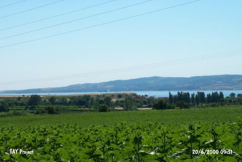 |
|
Type:
|
Mound |
|
Altitude:
|
19 m |
|
Region:
|
Marmara |
|
Province:
|
Çanakkale |
|
District:
|
Gelibolu |
|
Village:
|
Sütlüce |
|
Investigation Method:
|
Survey |
|
Period:
|
Classical |
|
|
|
 |
|
| It was founded on a promontory, 50 m from the sea, 3 km north of the Sütlüce Village, approximately 8 km southwest of Gelibolu (Gallipoli). The mound is on the northern bank of the Münipbey Stream and there are two fresh water springs on the skirts. It was discovered by M. Özdogan in 1982. Based on the collected sherds, it seems that it had been inhabited from the Late Chalcolithic Age until the Classical Period. Majority of the collected material belong to the Classical Period. Sherds dating to the EBA II and Troy I were found on the hilltop. Also found are sherds belonging to the Kumtepe Ib and Early Iron Age. It is suggested that it can be an important site as it has a thick deposit of Troy I. It takes place in the registered archaeological sites list prepared by Ministry of Culture and Tourism. |
| Location: |
| Geography and Environment: |
| History: |
| Research and Excavation: |
| Stratigraphy: |
| Small Finds: |
| Remains: |
| Interpretation and Dating: |