|
©The Archaeological Settlements of Turkey - TAY Project
|
|
|
|
|
|
Imamoglu Höyük |
|
|
For site maps and drawings please click on the picture... 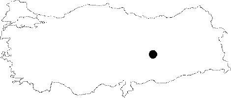 |
For photographs please click on the photo...  |
|
Type:
|
Mound |
|
Altitude:
|
693 m |
|
Region:
|
Eastern Anatolia |
|
Province:
|
Malatya |
|
District:
|
Battalgazi |
|
Village:
|
Imamli |
|
Investigation Method:
|
Excavation |
|
Period:
|
|
|
|
|
 |
|
| Location: It was located 800 m southwest of the Imamli Village of the Battalgazi District; northeast of the Malatya Province. It has been partly damaged by the flooding of the Karakaya Dam. It remained like an island for a long period of time. The latest excavation held in 1987 was conducted when it was an island. It is coded under P50 / 3. |
| Geography and Environment: Imamoglu Höyügü was located on a cobbled alluvial cone formed probably by the Euphrates; where the Höyük Stream and the Kirmizi Stream join. It was overlooking the Euphrates. It measured 14 m in height and 100 m in diameter. It was a conic hill with steep slopes. There was a small terrace on the north. |
| History: |
| Research and Excavation: First introduced as Imamli in 1945 by I.K. Kökten, it was re-documented by Ü. Serdaroglu and M. Özdogan who conducted a survey in the region. It was excavated in 1980-87 (8 campaigns) under the direction of E. Uzunoglu, an archaeologist from the Archaeological Museums of Istanbul. The excavations were mainly focused on the conic hill and its slope. |
| Stratigraphy: Stratification of the Imamoglu Mound is as follows: Layer I: Roman Period / Late Hellenistic Period Layer II: Iron Age Layer III: Late Bronze Age Layer IV: Middle Bronze Age Layer V: Early Bronze Age (VI): Inhabited during the Chalcolithic Age. There are numerous building levels dating to the Early Bronze Age. |
| Small Finds: Architecture: The second layer of the Imamoglu Mound belongs to the Iron Age. With an extensive and intense architecture, the deposit of this layer on the conic hill varies between 50 and 100 cm in thickness. However, it does not represent the overall thickness of the second layer. The foundations of the Iron Age buildings in the trench 6H at the center of the conic hill are seated on a nearly 30 cm thick burnt layer. No traces of fire are observed on the southern and southwestern sections of the hill because the Iron Age inhabitants removed a great portion of the cultural layers II and IV, and founded their buildings in these sections, the most suitable places for sun and wind, by means of terracing. That is why the cultural deposit of the Iron Age is thicker in that section. The buildings usually consisted of rectangular structures, in the south and southwest directions. Pottery: The Imamoglu mound yielded teapots and vessels with grooved rims known from the Early Iron Age layers in the Elazig-Malatya region. In general, the vessels were manually shaped. Some of the vessels bear dark traces of burning on their surface. The surface colors are usually in buffy reddish to brownish. They were thick-slipped, and also burnished. The ceramics are mainly dated to the Early Iron Age. Some with a globular body have a short cylindrical spout below the rim of the pots with horizontal lugs. Another version of these teapots are biconical vessels, with the rim decorated with a few lines of grooves in parallel to each other. The short and cylindrical spout rises from where the vessel becomes crested. The shoulder of a pot with stunted neck and grooved rim was decorated with incisions in small spots. Besides teapots, pots with biconical bodies and grooved rims and bowls with everted and deep rims. The excavations also yielded fire places and kilns in the rooms. Small Finds: Slags were uncovered in some rooms. A knob seal with hieroglyph inscription dating to the end of the Bronze Age or beginning of the Early Iron Age was recovered. Majority of the seals uncovered bear Urartian characteristics. |
| Remains: |
| Interpretation and Dating: Although samples uncovered at Imamoglu are dated to the 7th-8th century BC, they have great similarity to the samples dated to the Early Iron Age in the Elazig-Malatya region in terms of both technical and decorative aspects. While it is known that such material, particularly the grooved pottery was in use until the Middle Iron Age, grooved and spouted jugs indicate an earlier use. Among the finds is an interesting seal. With a bell shaped form, this stamp seal bears Urartian characteristics. |