|
©The Archaeological Settlements of Turkey - TAY Project
|
|
|
|
|
|
Güneyli Liman |
|
|
For site maps and drawings please click on the picture...  |
For photographs please click on the photo... 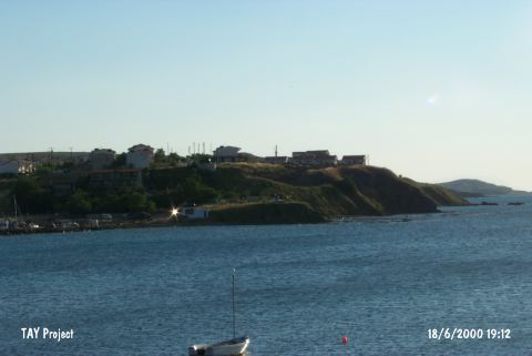 |
|
Type:
|
Mound |
|
Altitude:
|
15 m |
|
Region:
|
Marmara |
|
Province:
|
Çanakkale |
|
District:
|
Gelibolu |
|
Village:
|
Güneyli |
|
Investigation Method:
|
Survey |
|
Period:
|
Classical |
|
|
|
 |
|
| It is located on the smallest and lowest of the three promontories at the western end of the Güneyli Gulf, 3 km northeast of the Güneyli Village on the shores of the Saros Gulf, approximately 9 km northwest of Gelibolu. Two kilometers after diverting to the Güneyli Village, it lies on the area north of the village, 200 m below the Güneyli Street on the right. It was discovered in 1982 during the "Surface Survey in the Thrace and Marmara Regions" conducted by M. Özdogan. Partly under destruction at present, the Early Bronze Age sherds (Troy I type) were collected from the surface other than the Classical Period material. It takes place in the registered archaeological sites list prepared by Ministry of Culture and Tourism. |
| Location: |
| Geography and Environment: |
| History: |
| Research and Excavation: |
| Stratigraphy: |
| Small Finds: |
| Remains: |
| Interpretation and Dating: |