|
©The Archaeological Settlements of Turkey - TAY Project
|
|
|
|
|
|
Gökhöyük (Kirsehir-1) |
|
|
For site maps and drawings please click on the picture...  |
For photographs please click on the photo... 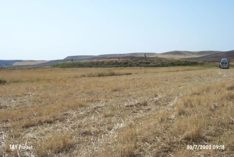 |
|
Type:
|
Mound |
|
Altitude:
|
705 m |
|
Region:
|
Central Anatolia |
|
Province:
|
Kirsehir |
|
District:
|
Çiçekdagi |
|
Village:
|
Konurkale |
|
Investigation Method:
|
Survey |
|
Period:
|
Early Iron Age Middle Iron Age Late Iron Age |
|
|
|
 |
|
| It lies 150 m south of the Delice Stream, 30 km west of the Mount Çiçekdagi, east of the Konurkale Village, north of Kirsehir. Referred as Kirsehir 1, 2 km north of the settlement runs the Ankara-Kayseri motorway. To the est lies the Gökhöyük 2 (Kirsehir-2) settlement. It measures 3 m in height, and 135 m in diameter. The sherds collected from the surface indicate presence of a 3rd and 1st Millennia settlement. Red and black nail impression decorated sherds of the Early Bronze Age were found. It is listed among the registered arcaheological sites by the Ministry of Tourism and Culture. |
| Location: |
| Geography and Environment: |
| History: |
| Research and Excavation: |
| Stratigraphy: |
| Small Finds: |
| Remains: |
| Interpretation and Dating: |