|
©The Archaeological Settlements of Turkey - TAY Project
|
|
|
|
|
|
Gavurevleri |
|
|
For site maps and drawings please click on the picture...  |
For photographs please click on the photo... 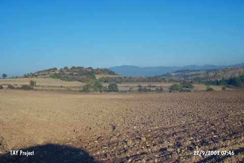 |
|
Type:
|
Mound |
|
Altitude:
|
750 m |
|
Region:
|
Black Sea |
|
Province:
|
Kastamonu |
|
District:
|
Daday |
|
Village:
|
Yazicimeydani |
|
Investigation Method:
|
Survey |
|
Period:
|
|
|
|
|
 |
|
| It rests on a slope descending down the Kincilar Stream with a very steep profile, almost 100 m north of the village so called Meydanköy or Yazicimeydani, southeast of the Daday District. It is an approximately 15 m high hill, with a diameter of 250 m and altitude of 750 m. The mound section of the settlement mainly sits on a natural rock. To the south and east is a wide terrace, which has been largely used for cultivation purposes at present. Remains of mudwalls with mudbrick and stone foundations are observed inside a nearly 3 m deep pit measuring 2x3m, dug by treasure hunters on the eastern slope of the mound. While mainly sherds of the Phrygian grey ware and rarely sherds dating to the Classical and Hellenistic Periods were collected from the terrace, sherds of red burnished ware from the 4th, 3rd and 2nd Millennia BC were found in the illicitly dug pit and on the hill. Due to its location, it is estimated that it had been continously inhabited for a long period of time. Intensive cultivation dissolves the deposits, and the sections that can be preserved particularly on the steep slope has been destroyed by illicit diggings. The survey conducted by A. Özdogan, C. Marro, A. Tibet, C. Kuzucuoglu in 1998 revealed that the illicitly dug pit was enlarged, and that the pit underwent a great fire, and also yielded outer corner of a structure with a mudbrick superstructure and stone foundation which has been preserved up to an height of 1.57 m, dating to the Middle/Late Bronze Age. This structure is overlaid by another architecture with stone foundation from the Iron Age. Data indicates that the main mound formation was during that period. Furthermore, it appears that the settlement expanded more following the Middle/Late Bronze Age. The Iron Age material consists of grit/sand tempered, sometimes burnished and red, but mainly grey ware. Particularly the grey ones are similar to the sherds found during the survey in 1995 as left from the treasure hunting activities carried out by grader at the Gödel/Kayabasi Tumulus to the southwest of Kastamonu. |
| Location: |
| Geography and Environment: |
| History: |
| Research and Excavation: |
| Stratigraphy: |
| Small Finds: |
| Remains: |
| Interpretation and Dating: |