|
©The Archaeological Settlements of Turkey - TAY Project
|
|
|
|
|
|
Gavur Tepe |
|
|
For site maps and drawings please click on the picture...  |
For photographs please click on the photo... 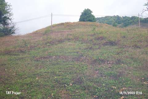 |
|
Type:
|
Mound |
|
Altitude:
|
390 m |
|
Region:
|
Black Sea |
|
Province:
|
Sinop |
|
District:
|
Erfelek |
|
Village:
|
Kazmasökü |
|
Investigation Method:
|
Survey |
|
Period:
|
Late Phrygian |
|
|
|
 |
|
| It is located within the borders of the Meydan Quarter, 1 km northeast of the Kazmasökü Village, 2 km southwest of the Mescitdüzü Village, 10 km west of Erfelek. It was discovered in 1987 during the Survey in the Province of Sinop conducted by M.A. Isin, and re-investigated in 1998 by S. Dönmez. M.A. Isin reports that the mound measures 100x70 m in dimensions while Dönmez informs that it has a dimension of 90x60 m with a height of 10 m. Sherds dating to the Early Bronze Age, Late Phrygian and Roman Period were collected from the surface. The Early Bronze Age pottery is sand- and plant-tempered. It is listed among the registered archaeological sites by the Ministry of Culture and Tourism. |
| Location: |
| Geography and Environment: |
| History: |
| Research and Excavation: |
| Stratigraphy: |
| Small Finds: |
| Remains: |
| Interpretation and Dating: |