|
©The Archaeological Settlements of Turkey - TAY Project
|
|
|
|
|
|
Elvançelebi |
|
|
For site maps and drawings please click on the picture...  |
For photographs please click on the photo... 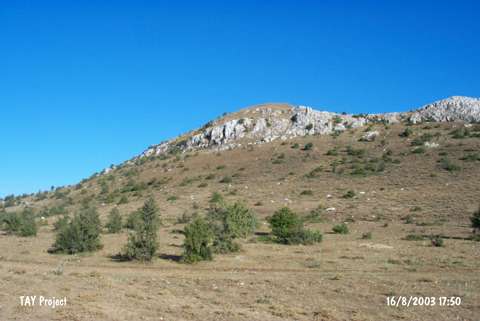 |
|
Type:
|
Mound |
|
Altitude:
|
1220 m |
|
Region:
|
Black Sea |
|
Province:
|
Çorum |
|
District:
|
Mecitözü |
|
Village:
|
Elvançelebi |
|
Investigation Method:
|
Survey |
|
Period:
|
|
|
|
|
 |
|
| It is located on the western section of the Elvançelebi Village of Mecitözü, on a relatively high ridge, overlooking the ancient road. It measures ca. 75x50x15 m in dimensions. It has a strategical location on a hill commanding the former Amasya-Mecitözü motorway. Traces of a fortification wall enclosing the mound were observed. To the north of the mound is a 15 m deep and 2 m wide illicitly dug pit. Sherds collected from the surface and around the illicitly dug pit belong to the Early Bronze Age, Hittite Period and Iron Age. The settlement stretches to the west of the mound on the lower skirts. The Iron Age settlement is a fortress type settlement like Pazarli. It is a flat mound lying in the northwest-southeast direction. The settlement spreads towards the fields to the north and east. Small and large stones of walls were observed on the mound. It was found out that some sections had been disturbed by illicit diggers. It is occasionally surrounded by trees. |
| Location: |
| Geography and Environment: |
| History: |
| Research and Excavation: |
| Stratigraphy: |
| Small Finds: |
| Remains: |
| Interpretation and Dating: |