|
©The Archaeological Settlements of Turkey - TAY Project
|
|
|
|
|
|
Elemenli Höyük |
|
|
For site maps and drawings please click on the picture...  |
For photographs please click on the photo... 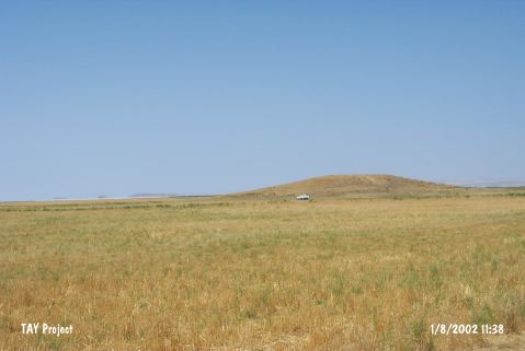 |
|
Type:
|
Mound |
|
Altitude:
|
935 m |
|
Region:
|
Central Anatolia |
|
Province:
|
Ankara |
|
District:
|
Sereflikoçhisar |
|
Village:
|
Hamzali |
|
Investigation Method:
|
Survey |
|
Period:
|
|
|
|
|
 |
|
| It lies 10 km southwest of the Sereflikochisar District in Ankara. It has a diameter of 98 m in the east-west direction, with a height of 14 m. It was discovered by I. Todd in 1965, and the site was dated to the Early Bronze Age by S.A. Kansu. It was visited during the Central Anatolia Survey conducted in 1992 under the direction of S. Omura. Traces of illicit diggigns are observed on the eastern slopes. Sherds collected from the surface are dated to the EBA, MBA, LBA and Iron Age. It was researched during the survey by S. Omura in 2003. The dimensions of the mound are: 270 m in north-south direction, 300 m in east-west direction, it is 11 m high. EBA and IA material were collected from the surface of the mound [Omura 2008:213; 217]. It takes place in the registered archaeological sites list prepared by Ministry of Culture and Tourism. |
| Location: |
| Geography and Environment: |
| History: |
| Research and Excavation: |
| Stratigraphy: |
| Small Finds: |
| Remains: |
| Interpretation and Dating: |