|
©The Archaeological Settlements of Turkey - TAY Project
|
|
|
|
|
|
Çinaz 1 |
|
|
For site maps and drawings please click on the picture...  |
For photographs please click on the photo... 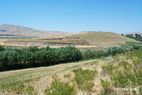 |
|
Type:
|
Mound |
|
Altitude:
|
1940 m |
|
Region:
|
Eastern Anatolia |
|
Province:
|
Elazig |
|
District:
|
Kovancilar |
|
Village:
|
Saraybahçe |
|
Investigation Method:
|
Survey |
|
Period:
|
Early Iron Age |
|
|
|
 |
|
| It lies 50 m south of the Elazig-Bingöl road; west of Saraybahçe (Cinaz) Village; 2 km northeast of Kovancilar District; east of Elazig Province. Ceramic finds dating to the Early Iron Age were collected from the surface of the mound. It was discovered by H. Bahar in 1987 and named as "Sekarat". If the data of Bahar and Burney is correct; then Sekarat measures 6 m in height and Cinaz 1 measures 25 m in height and 150x100 m. According to Bahar; Sekarat and Cinaz 1 are two different mounds. It was researched again during the Upper Tigris Region Archaeological Survey by E. Danik et al. in 2006. The dimensions of the mound were; 100x85 m in nort-south direction, and the plains at the top measured 100x50 m. The mound height differed between 10-20 m. It takes place in the registered archaeological sites list prepared by Ministry of Culture and Tourism. |
| Location: |
| Geography and Environment: |
| History: |
| Research and Excavation: |
| Stratigraphy: |
| Small Finds: |
| Remains: |
| Interpretation and Dating: |