|
©The Archaeological Settlements of Turkey - TAY Project
|
|
|
|
|
|
Dülük |
|
|
For site maps and drawings please click on the picture...  |
For photographs please click on the photo... 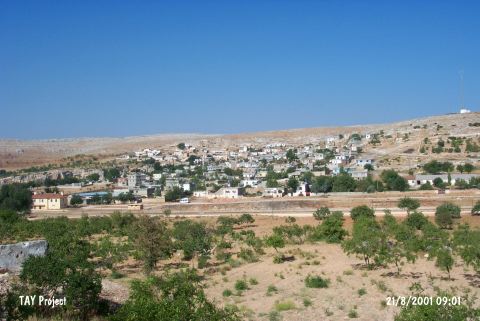 |
|
Type:
|
Habitation Site / Workshop |
|
Altitude:
|
915 m |
|
Region:
|
Southeastern Anatolia |
|
Province:
|
Gaziantep |
|
District:
|
Merkez |
|
Village:
|
Dülük |
|
Investigation Method:
|
Excavation |
|
Period:
|
AP OP |
|
|
|
 |
|
| Location: This site is around the village of Dülük; 11 km north of the city of Gaziantep; by the Dülük train station; in the vineyards on either side of the valley where the railroad tracks lie. |
| Geography and Environment: There are many rocky outcrops north; west and east of the village. The eastern part of the village is flat with the exception of the hill with rock-shelters at its base. The limestone is suitable for natural cave and rock-shelter formation. Bostanci surveyed the Zeyveli; Övelek; Kozluk stepped caves which are in and around the village houses; the entrance of the Kanli Cave; the village of Soguk and its vicinity and the district of Incirlik. Some of the natural limestone caves in the village are used as storage areas; barns and homes. The terraces at the outskirts of the village have been eroding since the Tertiary Period exposing wide areas with many flint nodules with calcareous deposits. These resources are among the reasons that attracted Palaeolithic hunter and gatherers to this area. Because of the high ironoxide mineral deposits; the soil in these terraces is a yellowish brick color. This mineral has given the chipped stone tools and nodules a bricky; yellowish patina. Many flint nodules; chipped stone tools and debitage products continue to be exposed as the fields and vineyards are plowed. |
| History: |
| Research and Excavation: The village of Dülük and its vicinity is probably the most researched site and has produced a large quantity of tools. The site was discovered by Muine Atasayan; who found Clactonien bifaces in the area called Yarikkaya or Güvey Kayasi right outside this village [Atasayan 1939a:161; fig. XVII-XVIII]. H.Th. Bossert; who did research in the area in 1945; found a massive; very well worked handaxe on the terraces above the village of Dülük [Çambel 1947:263]. This is still the largest handaxe ever found in Anatolia. I.K. Kökten and Enver Bostanci's 1946 survey yielded Chelléen and Abevillen biface handaxes in the area as well as Clactonien flakes and debitage products [Bostanci 1961:fig. I-IX; XI-XXI][Kökten 1952b:1998; fig. 2 & 3 lower level]. The next researcher; Refakat Çiner of Ankara University; collected some Lower and Middle Palaeolithic tools from the area in 1950. Another regional survey was conducted by Halet Çambel of Istanbul University in 1955. J. Perrot also did research around the village in 1961 and found some flakes; small bifaces and points [Perrot 1962:18]. The researcher who probably spent the most time in and around the village of Dülük is Enver Bostanci; who worked at the site in 1954; 1970; 1971 and in the following years [Bostanci 1975b:fig. 1-10]. Bostanci did not limit his research to surface surveys but also opened test trenches in two rock-shelters (the Dülük Köyü Rock Shelter) and in three caves (Sarkli Magara; Büyük Magara and Biçme Magara caves) (see each site individually). Bostanci also discovered a series of six terraces leading from the Dülük Valley to the district of Çetinkaya. He predicts that there was an open air settlement/habitation site on terrace IV because of the high density of the artifacts. Minzoni-Deroche's recent research in the area yielded several bifaces. They were collected immediately west of the village and south of Boynuzlukaya in Artifact Scatter 24. Also many bifaces were found approximately 1.5 km northeast of the village in Artifact Scatter 11 and 11A which is 2 km northeast of the village. It takes place in the registered archaeological sites list prepared by Ministry of Culture and Tourism. |
| Stratigraphy: |
| Small Finds: The research conducted here by various researchers produced a large quantity of flint biface handaxes as well as blades and flakes. We do not know the exact number of bifaces found but we suspect that there are at least 50. These bifaces are typologically Abbevillen; Middle Acheuléen or Upper Acheuléen. The researchers agree that they morphologically resemble European and Near Eastern examples. Bostanci proposes that the Acheuléen arrowhead found beyond the village on terrace IV in 1978 is the first and only Palaeolithic arrow head ever found in Turkey. Çiner believes that the area was used as a camp site/activity area in the transition to the Middle Palaeolithic because he found 2 Levalloiso-Moustérien flakes and 3 Levalloisien tools in the same place. Because the research done in this area was not systematic and artifacts were randomly collected with no documentation on provenience or terrace; and because geomorphological research did not accompany the archaeological survey; the results are limited. Minzoni-Deroche's systematic surveys will fill some gaps. In previous surveys there was a bias towards collecting biface handaxes. Yalçinkaya mentions that some Clacton type flakes and blades were found. Tomsky reports that the site yielded Lower and Upper Acheuléen bifaces. Although the biface found by Kökten is massive; it is closer to Acheuléen types than Abbevillien ones [Taskiran 1990:40]. |
| Remains: |
| Interpretation and Dating: |