|
©The Archaeological Settlements of Turkey - TAY Project
|
|
|
|
|
|
Çadir Höyük |
|
|
For site maps and drawings please click on the picture... 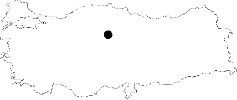 |
For photographs please click on the photo...  |
|
Type:
|
Mound |
|
Altitude:
|
1000 m |
|
Region:
|
Central Anatolia |
|
Province:
|
Yozgat |
|
District:
|
Sorgun |
|
Village:
|
Peyniryemez |
|
Investigation Method:
|
Excavation |
|
Period:
|
|
|
|
|
 |
|
| Location: The site lies in Peyniryemez Village; 13 km northwest of Alisar Höyük; in Yozgat. |
| Geography and Environment: The mound is located on a limestone reef; north of Egri Özü Valley extending from east to west. A stream flows south and west of the mound. It is 32 m high above the level of the plain and measures 240x185 m. The site has been moved towards northeast in time and has a lower terrace; extending 200 m in this area. It is reported that the region was much more watery when there was life at Çadir Höyük [Gorny et al. 1999:167]. Illicit digging pits are observed on top of the mound in last years. |
| History: |
| Research and Excavation: First excavations at Çadir Höyük were launched by H. von Osten and Erich Schmidt in between the years 1927 and 1932 with Oriental Institute at Chicago University as their sponsor. In 1993, during the Alisar Survey Project, survey team documented that the settlement was to be submerged by Gelingüllü Dam so they decided for a small scale excavation in 1994. After a short break, the site was excavated again in 1998 and excavations were carried out until 2009 under the directory of R.L. Gorny from the University of Chicago. In 2012, Gregory McMahon from the University of New Hamsphire the and his team started excavating at the site. |
| Stratigraphy: Later layers at Çadir Höyük belong to the Roman-Byzantine Periods, also yielding finds from the Late Iron Age, Dark Age and the 2nd Millennium, which are immediately underlied by Levels I and II dating to the Late Chalcolithic Age, and Level III dating to the Middle Chalcolithic Age in the stepped trench to the south and trenches on the summit [Gorny et al. 1999:152]. The periods and phases identified so far are as follows: X: Islamic IXa: Byzantine IXc: Byzantine IXd: Byzantine VI: Late Iron Age Va: Middle Iron Age Vb: Early Iron/LBA IVa: LBA II IVb: LBA I IIIa: MBA IIIb: MBA II IIa: EBA IIb: EBA IIc: Trans. EBA/Late Chalcolithic Ia1: Late Chalcolithic Ia2: Late Chalcolithic Ib1: Late Chalcolithic Ib2: Late Chalcolithic Ib3: Late Chalcolithic Ic: Early Chalcolithic Id: Early Chalcolithic Ie: Early Chalcolithic If: Neolithic [Gorny et al. 2006]. |
| Small Finds: Architecture: The chamber uncovered in the step trench which was opened on the eastern section in 1994 is probably of the Persian Period. Many sherds from the Iron Age were collected among mixed layers on the southern slope of the settlement. This material, in fact, has slided from the settlement on the upper section. In this case, the Iron Age settlement should have been founded on the upper section of the mound. The studies carried out in USS 4 in the upper southern slope in 2013 show that the area was used as both dwelling and activity area during Early IA. Semi-subterranean rounded buildings with a diameter of 2-3 m were exposed in the area. The floors of these buildings are plastered. It is revealed that the plaster was renewed at least five times. No remains belonging to mudbrick upper structure were found. Therefore, it is suggested that the roofs of these buildings were built with animal skin, mat or wattle supported via posts. Each building contains small pits that might have been used for refuse material. Along with these remains, mudbrick and stone architecture resembling the typical Hittite / LBA architecture were found. It is believed that these buildings used as dwellings were not unique for the settlement. Similar buildings were found in the levels dated to post-Hittite period of Gordion. These buildings were also known from Nevsehir Ovaören but the buildings found in this settlement were erected with stone walls [Serifoglu et al. 2015]. In 2014, the studies carried out in the main IA trench USS 4 revealed an uninterrupted stratigraphy, from Early IA to Late IA. There are dwellings and structures used for industrial purposes in this trench. This multipurpose area contains plastered circular holes that probably used for liquid storage and small pits that are full of ash, pebble and clay. The iron slag samples found on the building complex suggest that these buildings might have been used in one phase of mine production. These activities show great differences from the textile production activities seen in the later period of IA [Serifoglu et al. 2016:309]. Pottery: The Iron Age ceramics were mostly found as scattered material outside the layers. Therefore, they can be dated based on comparisons with similar groups. The closest correspondent of a sherd with an incision decorated rim from the Early Iron Age (12th-10th century BC) was found at Gordion [Genz 2001: pics. 1-2]. A few similar sherds are available at Büyükkaya and Kaman-Kalehöyük within the Kizilirmak curve. The closest parallels of a majority of the Early Iron Age material uncovered here are found at Büyükkaya. Among them are mainly red painted sherds [Genz 2001: pic. 1]. The Middle Iron Age (9th-8th century BC) material is mostly known as the Alisar IV or Büyükkale II pottery, with remarkable dark painted ware. Although geometric patterns are seen, animal figures presented in silhouette technique are more common. It is indicated that this type of material is well represented at Çadir Höyük [Gorny 1995: pic. 19; Genz 2001: pics. 3, 6-10]. The Late Iron Age (7th-4th century BC) is represented by gray material [Genz 2001: pics. 4, 2-3]. Some forms reflect characteristics of the period as well as the paste. Clay: The 2014 studies conducted in Trench SMT 15 and its vicinity yielded 13 clay balls and an ivory object. Some of the clay balls are perforated. It is possible that they were used as loom weight. The function of the well-made ivory object is unclear [Serifoglu et al. 2016:310]. |
| Remains: |
| Interpretation and Dating: |