|
©The Archaeological Settlements of Turkey - TAY Project
|
|
|
|
|
|
Buruncuk / Larisa |
|
|
For site maps and drawings please click on the picture...  |
For photographs please click on the photo... 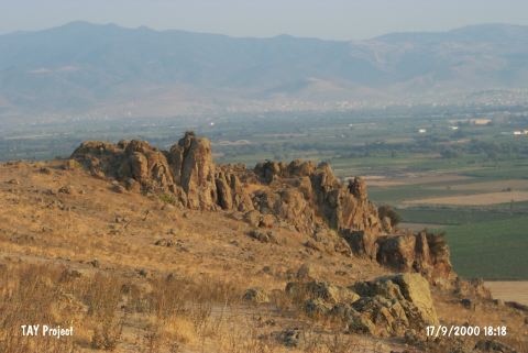 |
|
Type:
|
Flat Settlement |
|
Altitude:
|
90 m |
|
Region:
|
Aegean |
|
Province:
|
Izmir |
|
District:
|
Menemen |
|
Village:
|
Buruncuk |
|
Investigation Method:
|
Excavation |
|
Period:
|
Archaic Classical |
|
|
|
 |
|
| Location: It is located at the Buruncuk Village of the Menemen District, 28 km north of the provincial center of Izmir [Sevin 2001a:260]. |
| Geography and Environment: The Buruncuktepe on which the city of Larisa is located is the upper plain of a small nose like hill rising to the right after passing through the Gediz River. Buruncuktepe overlooks the Menemen Plain in all directions [Doger 1998:279]. |
| History: |
| Research and Excavation: It was excavated in 1902 and 1932-34 by German and Swedish archaeologists under the direction of J. Böhlau, K. Schefold, and F. Milter. It takes place in the registered archaeological sites list prepared by Ministry of Culture and Tourism. |
| Stratigraphy: |
| Small Finds: Architectural Remains: The walls of the acropolis were fortified around 500 BC, and completely renovated during the early 4th century BC [Bean 2001:80]. The first remains after the main gate is of a fortification wall, which was unearthed during the excavations, and preserved up to 3 to 4 m high. Walls of three building phases can be observed together next to each other in the well-preserved sections on the northwest. The intramural foundations unearthed belong to a palace and two different temples. One of the temples should have been dedicated to Athena, the patron goddess of the city. The palace should have belonged to the Persian governors, which ruled the region from the 6th century BC to the late 4th century BC [Doger 1998:280]. Behind the hill with remains of three modern windmills to the east of the acropolis lies the main part of the necropolis. Nearly a hundred tombs, mostly in the form of a tumulus, were found on the lower slope of the hill housing the windmills and the area between this slope and its neighboring hill. The tumulus tombs were formed by heaping over after erecting a low enclosure wall of polygonal masonry consisting of two or three rows of stones. The main burial is usually near the center of the tumulus, being delimited by vertically installed stone blocks. Some of the tumuli consist of two burials. One of the interesting features is that the most of the tumuli were expanded in time by addition of one or more circular blocks in various sizes. One of the tumuli had been expanded at least for four times in this way. Rarely they were built in rectangular form, sometimes divided into sections. Pottery: The excavations at the Buruncuk Fortress didn't yield any Hellenistic ceramics prior to the 800 BC [Doger 1998:278]. Necropolis is entirely dated to the 6th century BC based on the sherds uncovered. Among the finds unearthed during the excavations at Larisa are many terracotta figurines and fragments from the Archaic and Classical Periods. Also found are ceramics in krater, amphora, olpe forms and in sherds [Larisa III:59-64; Iren 2003:5]. Furthermore, oinochoe, skyphoscraters, plates, kraters and sherds from the Orientalizing Period were uncovered. Among the imported ceramics are sherds of cotyla and skyphoi from the Late Geometric Period, and sherds from the Archaic Period. Imported ceramics also include sherds decorated in red figure technique imported from Attica, and Attic black glazed vessels decorated with palmetto. Tomb: The dead were buried, no traces of cremation is observed [Bean 2001:81-82]. Miscellaneous: Fibulas, arrowheads, needles, glass fragments and tile samples were found. |
| Remains: |
| Interpretation and Dating: |