|
©The Archaeological Settlements of Turkey - TAY Project
|
|
|
|
|
|
Burga |
|
|
For site maps and drawings please click on the picture...  |
For photographs please click on the photo... 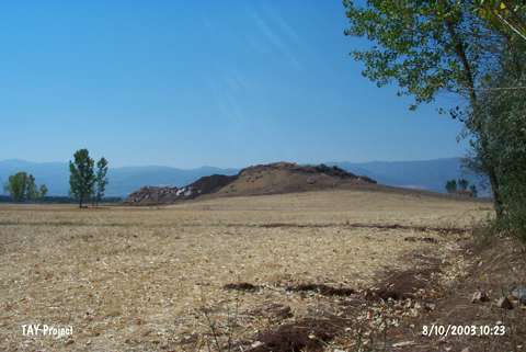 |
|
Type:
|
Mound |
|
Altitude:
|
1550 m |
|
Region:
|
Black Sea |
|
Province:
|
Tokat |
|
District:
|
Turhal |
|
Village:
|
Tatlicak |
|
Investigation Method:
|
Survey |
|
Period:
|
|
|
|
|
 |
|
| It lies to the northwest of the Pazar-Turhal motorway, 1.5 km north of the Tatlicak (Burga) Village, north-northwest of the Pazar Subdistrict in the Turhal District of Tokat. Discovered by G. Durbin, it measures 150x100 m in dimensions. EBA sherds, a painted Iron Age fragment and sherds from the Classical Period were collected from the surface. |
| Location: |
| Geography and Environment: |
| History: |
| Research and Excavation: |
| Stratigraphy: |
| Small Finds: |
| Remains: |
| Interpretation and Dating: |