|
©The Archaeological Settlements of Turkey - TAY Project
|
|
|
|
|
|
Asagi Pinar |
|
|
For site maps and drawings please click on the picture...  |
For photographs please click on the photo... 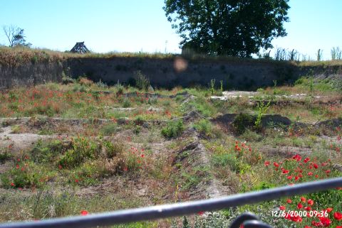 |
|
Type:
|
Mound |
|
Altitude:
|
130 m |
|
Region:
|
Marmara |
|
Province:
|
Kirklareli |
|
District:
|
Merkez |
|
Village:
|
Merkez |
|
Investigation Method:
|
Excavation |
|
Period:
|
Middle Iron Age Early Iron Age |
|
|
|
 |
|
| Location: The site lies south of the city of Kirklareli; on east side of Asibeyli village road; across the slaughterhouse of the town. It was discovered during the survey around Thrace and Marmara Region conducted by M. Özdogan; and published as Salhane in 1980. The mound is also cited as Kirklareli Höyügü in some publications [Özdogan et al. 1997b:53]. |
| Geography and Environment: Haydardere Stream runs through the north and west of the site. A spring with a strong flow rate is located at the west. The upper levels were probably destroyed by a tumulus that was built on top of the mound in the Late Antiquity. 40 cm thick; plastered enclosure wall; measuring 38 m in diameter and consisting of wood stakes; was built to prevent the soil erosion. The necessary soil for the construction of the tumulus was probably taken from the lower parts of the mound. Loamless soil was brought from other sources. It is interpreted that this tumulus was flattened for its valuable grave goods by the Russians invading Kirklareli in the Late 19th century. Finds; dating back from the Late Neolithic Age to the 4th century BC according to the Balkan chronology; were found at the site. This shows that the mound was medium in size before the tumulus was built [Özdogan-Parzinger 1995:51]. The excavation area is bordered with barb wire and the local house models built during the excavations can still be seen on the site. The new trenches are covered with wooden beams for protection. |
| History: |
| Research and Excavation: It is a settlement which was discovered during the surveys conducted under the direction of M. Özdogan, which also constitutes the most comprehensive excavation carried on within the content of the Thrace Project. The surface finds of Asagi Pinar were referred as Salhane in the publications, and these interesting finds were cited in many publications, however it was found out following the excavations that the actual name of the site was Asagi Pinar and it was also previously used by A.M. Mansel [Özdogan-Parzinger 1995:47, note 12]. Mansel mentioned presence of some remains from the Classical Period at Asagi Pinar. The excavations were initiated in 1993 by a collobration of M. Özdogan and H. Parzinger. In the following years, it turned out to be a multi-national project with the participation of Bulgarian, Spanish and Slovakian scientists. Researchs on disciplines such as archaeozoology, archaeobotanic, geology, archaeometallurgy, archaeophysics were simultaneously carried out along with archaeological researchs. In 1994, a geophysical screening was conducted, following a series of soundings carried out in a wide area in 1995 in order to test the outcomes. It is reported that an area of 2000 squaremeters was opened on the surface of the mound as a result of excavations in 1997. |
| Stratigraphy: The stratigraphy has been almost identified after 5 years of study. The uppermost level is the first layer which include mixed deposits of the tumulus disturbed during the Russian invasion, soil removed both from the skirts of the mound and its vicinity during the construction of the tumulus, and remains of enclosure wall of the tumulus. This mixed deposit is underlied by a second layer which was partly disturbed by the Iron Age pits. It seems that the structures which were orderly lined up with wide spaces in between were protected by an enclosure wall. The settlement plan of the layers 3 and 4 is similar to the one in layer 2. However, the structures are sparser. The settlement plan of the layer 5 is different than the upper layers. The houses were built in a regular plan. The village of this layer was surrounded by a defense ditch. The layer 6 yielded a Late Neolithic-Early Chalcolithic Age village which was full of houses built adjacent or very close to each other. Other layers are dated to the Early and Middle Chalcolithic Age in the chronology of Anatolia. Stratification on the mound based on 2009 excavations: Neolithic Period (8th-6th levels; 6400-5700 BC) Transition Period (Neolithic-Chalcolithic Transition) Chalcolithic Period (5th-1st levels 5500-4800 BC) Besides the stratified deposits, based on available information, the southwest of the mound was used during Iron Age as a sanctuary, and a tumulus was built which was later demolished [Özdoğan et al. 2009:233]. |
| Small Finds: Architectural Material: The first surprise of the excavations at Asagi Pinar was the traces of a considerably disturbed tumulus on the settlement, which resulted in a completely flat settlement. The tumulus which was built during the 6th or 5th century BC with the soil removed from the Chalcolithic mound measures 38 m in diameter. It seems that it didn't have a stone temenos wall, but surrounded by a wood fence in order to prevent landsliding. The tumulus was probably flattened during the Middle Age, and the soil was spreaded onto a wide area. Özdogan informs that although tumulus formed a protective coating for the underlying deposits, presence of dense sherds dating to the Chalcolithic Age may lead to confusion in evaluating the surface finds [Özdogan et al. 1997b:5]. It was found out that this area was used as a sacred area according to the Thracian traditions between 8th and 6th centuries BC before the construction of tumulus. The sacred area was surrounded by a regular shaped round ditch with a diameter of 120 m, a width of 7-8 m and a depth of 3.5 m [Özdogan et al. 1997b:4]. There are only votive pits in the area [Özdogan-Parzinger 1995:pic. 4b]. Özdogan reports that there are many examples of such votive places belonging to the Thracian tribes, some with a tumulus built atop as it was at Asagi Pinar [Özdogan et al. 1997b:6]. It was found that pits from the Middle and Early Iron Age under the disturbed layer of tumulus were usually empty, and no architectural traces were observed. Pottery: The pits yielded sherds from the Middle Iron Age. Only a few sherds of the cord impressed ware, very typical of Thracia during the Iron Age, were uncovered [Özdogan-Parzinger 1995:52]. Among the finds are fragments of amphoras and imported pottery [Özdogan et al.1997b:5, pics. 7, 8]. Metal: The pits yielded wristguards and a bird fibula from the Early and Middle Iron Age [Özdogan et al. 1997a:pics. 15-17; Özdogan et al. 1997b:5, pics. 9-12]. |
| Remains: |
| Interpretation and Dating: Based on the sherds, it is reported that the Middle Iron Age was more frequent on the mound [Özdogan-Parzinger 1995:52]. |