|
©The Archaeological Settlements of Turkey - TAY Project
|
|
|
|
|
|
Arapkahve |
|
|
For site maps and drawings please click on the picture...  |
For photographs please click on the photo... 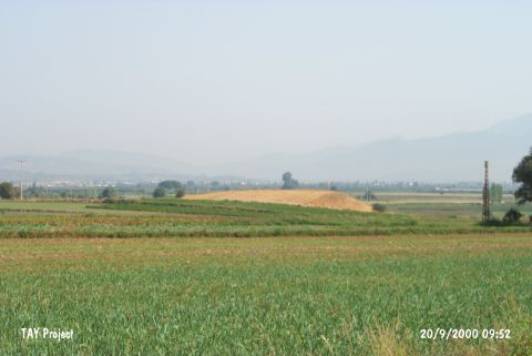 |
|
Type:
|
Mound |
|
Altitude:
|
20 m |
|
Region:
|
Aegean |
|
Province:
|
Izmir |
|
District:
|
Torbali |
|
Village:
|
Özbey |
|
Investigation Method:
|
Survey |
|
Period:
|
Archaic |
|
|
|
 |
|
| It is located west of the village of Özbey; 3 km north of the ancient city of Metropolis; south of Izmir Province. It lies to the immediate west of the brook it was named after. The mound expands onto an area of 60x150 m in the northeast-southwest direction [Tuna 1988: 304-305]. Situated around Metropolis in the Izmir-Ephesus passage extending from north to south, the mound has a strategical location overlooking the Küçük Menderes Plain, the Kolophon region and the Karabel Strait. Presence of a settlement from the 6th century BC was identified [Meriç 2003:37]. It takes place in the registered archaeological sites list prepared by Ministry of Culture and Tourism. |
| Location: |
| Geography and Environment: |
| History: |
| Research and Excavation: |
| Stratigraphy: |
| Small Finds: |
| Remains: |
| Interpretation and Dating: |