|
©The Archaeological Settlements of Turkey - TAY Project
|
|
|
|
|
|
Alpanoz |
|
|
For site maps and drawings please click on the picture...  |
For photographs please click on the photo... 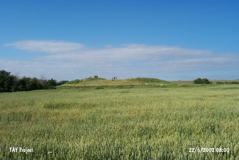 |
|
Type:
|
Mound |
|
Altitude:
|
985 m |
|
Region:
|
Central Anatolia |
|
Province:
|
Eskisehir |
|
District:
|
Seyitgazi |
|
Village:
|
Sarayören |
|
Investigation Method:
|
Survey |
|
Period:
|
Early Phrygian Middle Phrygian Late Phrygian |
|
|
|
 |
|
| It lies 1 km east of the Eskisehir-Seyitgazi Highway; 12 km away from Seyitgazi; south of Eskisehir Province. It is located 600 m east of the road 1.8 km east-southeast of Sarayönü (Alpanoz) Village. It measures 100 m in diameter, and 5 m in height. It includes material groups from the EBA II-III, 2nd Millennium BC and Phrygian Period. The surface has been cropped to a great extent, and illicitly dug pits are observed on the eastern section. It takes place in the registered archaeological sites list prepared by Ministry of Culture and Tourism. |
| Location: |
| Geography and Environment: |
| History: |
| Research and Excavation: |
| Stratigraphy: |
| Small Finds: |
| Remains: |
| Interpretation and Dating: |