|
©The Archaeological Settlements of Turkey - TAY Project
|
|
|
|
|
|
Aharköy Hüyük |
|
|
For site maps and drawings please click on the picture...  |
For photographs please click on the photo... 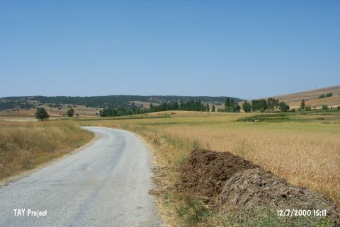 |
|
Type:
|
Mound |
|
Altitude:
|
950 m |
|
Region:
|
Marmara |
|
Province:
|
Bilecik |
|
District:
|
Inhisar |
|
Village:
|
Yesilyurt |
|
Investigation Method:
|
Survey |
|
Period:
|
|
|
|
|
 |
|
| It is located 2 km to the southwest of the Yeşilyurt Village (Aharköy), southeast of the city center of Bilecik. It is reported to be 4-5 m in height and 100 m in diameter. The western section has been partly destroyed during the laying of the natural gas pipelines. It is one of the small-size mounds of the region. Located 5 km to the north of the Demircihöyük settlement, it was surveyed by the excavation team of Demircihöyük in detail, and sherds and cut stone samples were found during the surface collection. T. Efe reports presence of material from the First Bronze Age II and III, and limited number of sherds from the Phyrgian and Classicial Periods [Efe 1990a:412]. It takes place in the registered archaeological sites list prepared by Ministry of Culture and Tourism. |
| Location: It is situated 2 km southwest of the Yesilyurt Village (Aharköy); southeast of the Bilecik Province. |
| Geography and Environment: It measures 4-5 m height and 100 m in diameter. It has been partly destroyed (west part) during the installation of the natural gas pipelines. It is one of the small sized mounds of the area. |
| History: |
| Research and Excavation: |
| Stratigraphy: |
| Small Finds: |
| Remains: |
| Interpretation and Dating: |