|
©The Archaeological Settlements of Turkey - TAY Project
|
|
|
|
|
|
Domali - Alaçali |
|
|
For site maps and drawings please click on the picture... 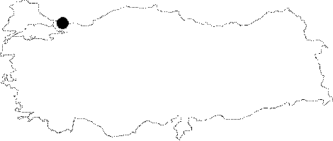 |
For photographs please click on the photo...  |
|
Type:
|
Habitation Site / Workshop |
|
Altitude:
|
m |
|
Region:
|
Marmara |
|
Province:
|
Istanbul |
|
District:
|
Sile |
|
Village:
|
Domali |
|
Investigation Method:
|
Survey |
|
Period:
|
ÜP EP |
|
|
|
 |
|
| Location: This site is located approximately 44-45 km northwest Istanbul; northeast of the town of Alaçali. Chipped stone tools were found near the village of DOMALI on the three rows of sand dunes by the Black Sea coast [Gatsov-Özdogan 1994:108]. This site includes a collection of artifact scatters. Some artifacts were collected on the first row of sand dunes known as the Göztepe Dunes and on the Dereagzi Hillock east of the Kazlar Deresi Stream [Özdogan 1983a:map on p.141]. A second scatter of artifacts was discovered by Özdogan during his 1984 survey. He found chipped stone artifacts on the MÜRSELLI BABA Ridge which is approximately 200 m inland and about 2 km north-northwest of the the village of Domali. The third set of dunes by the hill known as TEKMEZAR also yielded a large number of artifacts. Similar finds can be found on different dunes such as at the site of DOGANÇALI and further east at the site of ALAÇALI [Özdogan 1986a:411]. The sites here were most probably seasonally inhabited. The survey code of this site is D 14 / 5-7. |
| Geography and Environment: There are many sand dunes along the Black Sea coast such as Agacli; Gümüsdere and Kilyos. Small streamlets that empty into the Black Sea which spring from the inland parts of the dunes give the region an undulating appearance. |
| History: |
| Research and Excavation: The artifact scatters listed above were discovered by Mehmet Özdogan during his 1981 and 1984 surface surveys of Thrace and the Marmara Region. It takes place in the registered archaeological sites list prepared by Ministry of Culture and Tourism. |
| Stratigraphy: |
| Small Finds: The microlith tools found at this open-air site date to the end of the Upper Palaeolithic and to the Epipalaeolithic Period. Özdogan's map shows three different artifact scatters. The scatters all have a low artifacts density. The survey yielded a microlith blade core; blades with and without edge wear; end scrapers and other examples of chipped stone tools made from flint. Tools that resemble those collected on former Gümüsdere and Agaçli surveys were found on the Mürselli Baba Ridge and on Akçali Beach in 1984. These tools include microlith and geometric tools and tools made on micro-blades. They were mostly flint although obsidian was also found. |
| Remains: |
| Interpretation and Dating: |