|
©The Archaeological Settlements of Turkey - TAY Project
|
|
|
|
|
|
Doganci |
|
|
For site maps and drawings please click on the picture...  |
For photographs please click on the photo... 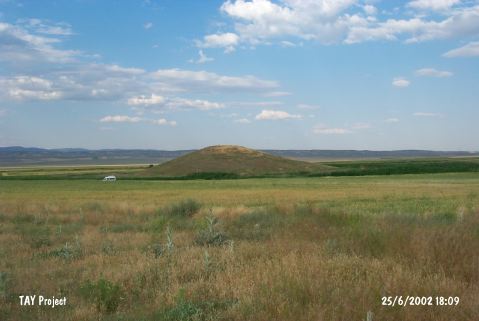 |
|
Type:
|
Mound |
|
Altitude:
|
795 m |
|
Region:
|
Central Anatolia |
|
Province:
|
Eskisehir |
|
District:
|
Alpu |
|
Village:
|
Merkez |
|
Investigation Method:
|
Survey |
|
Period:
|
EBA II EBA III |
|
|
|
 |
|
| It lies 4.7 km north from Alpu; 400 m east of the Alpu-Çukurhisar motorway; east of Eskisehir Province. There is a survey point on top hill. It was discovered during the Kütahya; Bilecik and Eskisehir survey conducted by T. Efe in 1994. It measures 16 m in height and 152 m in diameter. It is surrounded by swamp and reeds. Pottery dating from the EBA II-III and second millennium BC collected from the surface exposes that the site had been inhabited during above mentioned periods. It takes place in the registered archaeological sites list prepared by Ministry of Culture and Tourism. |
| Location: |
| Geography and Environment: |
| History: |
| Research and Excavation: |
| Stratigraphy: |
| Small Finds: |
| Remains: |
| Interpretation and Dating: |