|
©The Archaeological Settlements of Turkey - TAY Project
|
|
|
|
|
|
Dervisli |
|
|
For site maps and drawings please click on the picture...  |
For photographs please click on the photo... 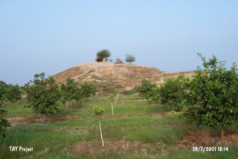 |
|
Type:
|
Mound |
|
Altitude:
|
70 m |
|
Region:
|
Mediterranean |
|
Province:
|
Adana |
|
District:
|
Seyhan |
|
Village:
|
Dervisler |
|
Investigation Method:
|
Survey |
|
Period:
|
|
|
|
|
 |
|
| It is located 3 km south of Dervisli Village; on the southern part of the Çaputçu-Dervisli motorway; 24 km southwest of Adana Province. It lies 1.5 km west of the Seyhan River. It is a small mound; 7 m high. During the Cilicia Survey conducted by M.V. Seton-Williams in 1951; sherds of the Chalcolithic Age; the EBA; the second millennium BC; the Iron Age; the Hellenistic and Roman Periods were collected from the surface. |
| Location: |
| Geography and Environment: |
| History: |
| Research and Excavation: |
| Stratigraphy: |
| Small Finds: |
| Remains: |
| Interpretation and Dating: |