|
©The Archaeological Settlements of Turkey - TAY Project
|
|
|
|
|
|
Sariket Mezarligi |
|
|
For site maps and drawings please click on the picture...  |
For photographs please click on the photo... 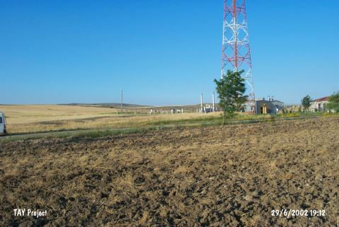 |
|
Type:
|
Cemetery |
|
Altitude:
|
855 m |
|
Region:
|
Marmara |
|
Province:
|
Bilecik |
|
District:
|
Sögüt |
|
Village:
|
Zemzemiye |
|
Investigation Method:
|
Excavation |
|
Period:
|
EBA I EBA II |
|
|
|
 |
|
| Location: It lies immediate west of the exit to Sögüt; north of the Bursa-Istanbul highway; south of the Zemzemiye Village; about 25 km west of Eskisehir on the border of the Bilecik-Eskisehir Provinces. The cemetery called Sariket is located 1.2 km south of the site of Demircihöyük. |
| Geography and Environment: Demircihöyük is a small hill; ca. 5 m high above the plain level. The western side has been eroded by a stream passing by; located on the edge of a small plain irrigated by the Sansu Stream in a transition point to the coastal Marmara. The Sariket cemetery has been severely damaged by the pits of natural gas piping; besides deep ploughing. Since the plain was filled up for thousands of years due to erosion; the remains of the first inhabitants of Demirci Mevkii were brought to light only after 7-8 m below the plain level. The water table at 4-6 m depth made it harder to excavate the lower levels. Exposure of pottery dating from the Neolithic and Chalcolithic Ages inside the mudbrick walls of EBA structures led the excavator to suggest the presence of a mound belonging to these ages. For removal of clay earth; probably an earlier mound was preferred and remaining of this mound was locked under an alluvium deposit. The cultural deposit is ca. 12 m thick. The mound is presumed to be located on a trade road between the Anatolian Plateau and the Sakarya River or the Marmara Depression. The modern highway simulating the same route supports this thesis. |
| History: |
| Research and Excavation: It was excavated in 1937 by K. Bittel in the name of the Deutsch Archaeological Institute [Bittel-Otto 1939] followed by M. Korfmann in 1975-78 and; the cemetery of Sariket was excavated under J. Seheer in 1990-91 in the name of the Museum of Bursa and the Deutsch Forschungensgemainschaft. Before the excavation of the cemetery; the remains beneath the earth were traced by means of magnetometer and particularly the mouths of the pithoi were verified before digging the stone piles around them as well as verifying the dimensions of the cemetery and approximating the number of the graves [Jansen 1991:120-124]. It takes place in the registered archaeological sites list prepared by Ministry of Culture and Tourism. |
| Stratigraphy: As a result of the recent excavations lasted nearly for four seasons; the archaeology of Demircihöyük was almost illuminated. 17 layers were discovered starting from the depressed layer or Q layer identified as the layer of which the architectural remains being demolished; to the lowest layer; layer A. The lowest layers didn't yield any architectural remains; but were identified during the soundings. Exposure of no changes in the architectural plans from layer C to the top layer; layer P except minor changes is very amazing. The settlements abided in the old traditions and plan within a few centuries created a very thick cultural deposit. The stratification of Demircihöyük is roughly as follows; Layer C-K: EBA I Layers L-P: EBA II The mound was abandoned after the EBA settlement for a few centuries and then re-occupied during the Middle Bronze Age. Following that period; the mound was not inhabited. During the Hellenistic Period; there is a small and temporary settlement on the terraces of the hill. The cemetery revealed not only EBA graves; but also graves dating from the MBA and the Hellenistic Period in accordance with the settlement phases of the Demirci mound. |
| Small Finds: Architecture: In spite of the continuity regarding the construction plans of EBA settlements; there are differences in the construction materials. Adjacent; regularly aligned trapeze structures were built in the form of rings. This order continued for several centuries from bottom to top without any major change. The diameter of the settlement is ca. 70-80 cm. Even tough only two gates were discovered; it is presumed to have a total of four gates; considering that there should be two more symmetrical gates. The floor of one of these gates is stone paved. Except a three-roomed house next to the main gate; all the houses have a two-roomed and crooked/trapeze plan. The doors of the houses open to the square of the village. A lot of barns dug into the earth cover a large area of the square. It is presumed that the outer walls of the buildings probably have a few windows. The roofs of the adjacent buildings constitute a flat surface which was used for drying the fruits and cereals besides being utilized as ateliers. The roofs were reached by wooden ladders. During the construction of houses at layers D-H; fence was used instead of mudbrick wall. The intervals between the wattles driven into the earth were daubed and a fence wall was built. Both sides of this wall were coated with clayed earth several times to isolate the heat and cold. From the building level F1; outside the construction ring; a battered city wall; sometimes projected like a saw; was built. Also reinforced with quadrangular towers; the sub- and super-structures of the wall are of mudbrick. With its battering; this city/fortification wall gives an impression of a ca. 7 m high wall for an enemy in a distance of 5 m; therefore it has a dissuasive appearance. The outer ditch also plays an important role. Also the walls of the closed buildings create a second set. All these elements make it appear like a castle. After layer H which underwent a fire; the village was re-built by walls consisting of a substructure of stones and superstructure of mudbricks instead of a wooden fence. The entrance/exit apertures of the village are presumed to be closed by a wooden door when needed. A house next to one of the gates is distinctive than the others in terms of the construction material and plan. M. Korfmann proposes that this house belonged to a person in a different status; probably to the chief of the village. In front of the other houses; there is a storage pit with a volume of 5 m3 capped by timber. The owners of the houses stepped over these pits while entering their home. The front room houses beds and the rear room kiln and ash pit; sometimes a hearthplace. The 13 out of 26 houses were excavated. The excavator suggests that some 130 people resided in the village; each house took in 5-6 persons. Each house covers an area of ca. 50 squaremeters. They have party walls. The roofs are flat; and probably a large part of the daily life was spent there. The inner part of the construction ring; the square of the village; is like a courtyard. It also functioned like an atelier; even as a pen. The construction plan reflects a common community life due to the socioeconomic factors. Pottery: The pottery of levels D-H of EBA layers were analysed by J. Seheer in detail while the pottery of H-P/Q by T. Efe. For T. Efe; there are three main groups of ware: 1. black burnished ware; 2. red washed burnished ware; and 3. coarse unwashed ware [Efe 1988:7-11]. The red washed burnished ware is usually dominant. The first group also includes the black rimmed ware. All of those ware groups includes handmade bowls; necked jars; spouted pitchers; jars; open pithoi; necked pithoi; trays and small cups. Vast majority of the coarse ware vessels has ear-like lugs. It is noted that the black rimmed bowls and loop handled vessels of the orange colored burnished group of ware in the style of Northwestern Anatolia appear from EBA I in this region and then from the beginning of EBA II expand to a wider area till Ankara over Iznik and Inegöl plains. T. Efe bases the long-lasting of some ware on the presence of many city states during EBA in this region. Clay: About 200 idols were found. Aside naked woman depictions presumed to be of goddess; plenty of animal figurines were recovered. Among them; the bull figurines are suggested to represent the god. Also found are weaving and spinning tools and brush handles in clay. Ground Stone: Flintstone and obsidian tools and flakes were found. Metal: A stone casting mould points out that metal; even small; was cast in the settlement. However; no finds were recovered. SARIKET CEMETERY: The terrace 250 m west of Demircihöyük settlement was used as a necropolis both during EBA & MBA and Hellenistic Period by the inhabitants. The burial practices of EBA and MBA are similar. As this terrace is called Sariket; this extramural cemetery was called the cemetery of Demirci-Sariket. The cemetery area measures 60x50 m in dimensions. 497 graves dating from the EBA were uncovered. The graves are in the northwest-southeast direction. Although there are some spaces between the graves; they are more dense in the center. As some of the lower graves were damaged by the upper ones; it seems that they were probably not marked. Three types of graves dating from the EBA were identified at Sariket; 1- Pithos Graves: This is the most common grave. Across the pithos being very small to cover a burial; another pithos was added so that the grave was enlarged. The mouth of the pithos was capped completely by a flat stone plate or sherds; and then it was covered with earth. The dead were buried into the grave in contracted position. It is suggested that pithoi were employed for storing grains and water; but also for burials when required. 2-Cist Graves: This type of graves is built neatly by flat limestone plates probably conveyed from long distances. They were also capped by stone plates. J. Seeher reports that he has never seen such sound stone graves among the contemporary graves in Anatolia. 3-Simple Pit Burials: Some are surrounded with stones. They are poor in number compared to other types. After the dead were placed into the pit; it was capped by wooden remains and covered with earth. Much same as the other graves; the dead was buried in hocker position; hands near the face or chest; leaning on his/her right or left. The number of double burials is not much [Seeher 1993:pic.6]. Both adult and infant skeletons were found. Unrevealing any bones in some of the graves is probably related with the disturbance of the graves. They might also be memorial graves. The value and the number of grave goods do not change according to the type of grave. No grave which could be identified as chief's grave was found. It is noted that some graves were plundered during EBA or MBA. Exposure of cattle bones found above or below the graves indicates that probably the meat of these animals was eaten or they were sacrificed during the burial ceremony. There is a tradition of burial feast. Grave Goods: Both inside and outside the graves; very rich and rare goods were found. No grave goods were recovered from some graves [Seeher 1999:54]. Aside tools for daily use; some weapons were found near the skeletons of males. Almost all graves house at least one jug. The majority of the handles start right below the rim. They are spouted. The bowls are twisted as "S". Single handled bowls (tankards) were also found [Seeher 1993:pic.12] as well as basket handled vessels and teapots. Those latter forms were not found during the Demircihöyük excavation. They probably belong to the late period of EBA II. Among the finds; there are small cups decorated with chevrons. Golden; silver; copper/bronze and diadem frontons were recovered. Those objects produced like thin sheets have relief decorations. Amazing thing is that these delicate objects are found both in graves of male; female and children. The mace/baton head decorated with projections like two rows of mushrooms in copper/bronze probably belongs to an important person in the society. A crescentric axe; besides a lead cup; found in one of the male's graves represents one of the best examples of this type. Plenty of metallic pins with eyelet and decorated head were recovered. Of metallic weapons; flat and shaft-holed axe [Seeher 1992b:fig.6/2]; spit-like spearhead [Seeher 1992b:fig.6/3]; terra cotta and stone idols related with mother goddess cult [Seeher 1992b:fig.7/3-4] were found. Among other finds are strings of beads in gold; bronze; carnal and rock crystal; bronze bracelet; bronze razors; lead and bronze earrings. The graves house the goods only survived to the present day. It is certain that materials like wood; leather and cloth were also left into the graves. Fauna: Sheep; goat; cattle and pig were domesticated. On the south of the settlement; probably remains of a pen were found. Bones of hunted animals were recovered. Flora: Exposure of emmer and einkorn in the bottom of the storage pits and food wells points out that the agriculture played an important role in their living economy. |
| Remains: |
| Interpretation and Dating: The excavation of Demircihöyük has laid out that societies; who were loyal to their traditions and made no change in the settlement plan for long lasting years; occupied the site during the EBA I and II in a range between 3.000/2.900 and 2.500/2.400 BC. The excavator calculates each layer; some underwent a fire; at least over 30 years; and concludes a total period of ca. 500 years; given the 17 layers. At least two layers underwent a massive fire. M. Korfmann presents it as a fortified site; typical of Northern Anatolia and suggests that the construction tradition was enforced by the principal residing in the settlement or in the vicinity. It is noted that the storehouses cover a larger area than the food of the inhabitants so that it was a village with mixed economy involved in trade being located on the migratory and caravan road; and the economy was largely based on agriculture and animal husbandry. Demirci; probably; was a settlement of a community controlling the tin beds; of which the samples didn't survive to present day; or clay beds. EBA settlement was terminated with a disaster. J. Seeher reports that the cemetery of Demirci-Sariket is contemporary with layers L-P dating from the EBA II on the basis of the grave finds [Seeher 1992:165]. Although the analysis of the human skeletons was not completed yet; their bone and tooth structures expose that they were healthy people. The investigator gives an average life of 30-35 years [Seeher 1999:55]. The women are presumed to live shorter due to the hard living conditions. The cemetery of Sariket has almost identical characteristics with the cemetery of Küçükhöyük in the vicinity; and it played an important role by providing information about the burial practices of this region by means of an attentive excavation and refined publication. |