|
©The Archaeological Settlements of Turkey - TAY Project
|
|
|
|
|
|
Dellenpinari |
|
|
For site maps and drawings please click on the picture... 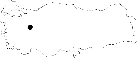 |
For photographs please click on the photo...  |
|
Type:
|
Single Findspot |
|
Altitude:
|
m |
|
Region:
|
Aegean |
|
Province:
|
Kütahya |
|
District:
|
Altintas |
|
Village:
|
Yayla |
|
Investigation Method:
|
Survey |
|
Period:
|
OP ÜP |
|
|
|
 |
|
| Location: This site is in the Kütahya province; in the Altintas district; immediately east of the Altintas-Çalköy-Dumlupinar highway close to the Cirlek (Cirliyek) turnoff. The site lies opposite the streamlet on the flat area locally known as the Dellenpinari Plain; southwest of Hebilin Höyük. |
| Geography and Environment: The Porsuk Stream springs from the Altintas Region where the site is located. There is no bordering chain of mountains dividing the Altintas Plain from the Afyon Plain. The region is bounded by the Murat Mountains to the south and by smaller mountains to the north and west. There is a fresh water spring between Dellenpinar and Hebilin Höyük. |
| History: |
| Research and Excavation: The site was discovered by Turan Efe in 1991 during his survey of the Dellenpinar Region. At this open-air site; Efe found some Palaeolithic tools along with some Late Chalcolithic Pottery. Although we are not informed about artifact densities; it is proposed that this site was a temporary Palaeolithic camp-site. |
| Stratigraphy: |
| Small Finds: All the flint tools the site yielded are either flakes or blades which Efe has assigned to the Upper and Middle Palaeolithic [Efe 1993:352; fig.19-20]. |
| Remains: |
| Interpretation and Dating: |