|
©The Archaeological Settlements of Turkey - TAY Project
|
|
|
|
|
|
Dana Höyük |
|
|
For site maps and drawings please click on the picture...  |
For photographs please click on the photo... 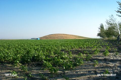 |
|
Type:
|
Mound |
|
Altitude:
|
120 m |
|
Region:
|
Mediterranean |
|
Province:
|
Hatay |
|
District:
|
Kirikhan |
|
Village:
|
Topbogazi |
|
Investigation Method:
|
Survey |
|
Period:
|
EBA II |
|
|
|
 |
|
| It lies on the Top Strait on the northwestern end of the Lake Amuq; southwest of Kirkhan; northeast of Antakya Province. To the west runs the Antakya - Kirkhan highway. The access to the mound; only 1 km away from the highway; is very easy. It was discovered by R. Braidwood in 1935. The materials recovered were evaluated in accordance with the excavations carried out on the plain. It is a small and low mound. The inhabitants of the mound surrounded by fertile fields were getting their fresh water from the small streams originating from the Gavur Mountain. Sherds of EBA; and probably Roman Period and MBA were collected from the surface. |
| Location: |
| Geography and Environment: |
| History: |
| Research and Excavation: |
| Stratigraphy: |
| Small Finds: |
| Remains: |
| Interpretation and Dating: |