|
©The Archaeological Settlements of Turkey - TAY Project
|
|
|
|
|
|
Dana Höyük |
|
|
For site maps and drawings please click on the picture...  |
For photographs please click on the photo... 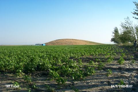 |
|
Type:
|
Mound |
|
Altitude:
|
120 m |
|
Region:
|
Mediterranean |
|
Province:
|
Hatay |
|
District:
|
Kirikhan |
|
Village:
|
Topbogazi |
|
Investigation Method:
|
Survey |
|
Period:
|
|
|
|
|
 |
|
| Small and flat mound lies northwest of the city of Antakya; 1.3 km southeast of Antakya-Kirikhan road; northeast of Amuq Plain; at the east entrance of Topbogazi Village. It was very close to the shore and to the swamps before the lake was desiccated. The site was discovered during the Amuq Plain Survey conducted by R.J. Braidwood in 1936. Debatable Chalcolithic Age ceramics and 3rd Millennium BC; 2nd Millennium BC; Hellenistic and Roman Period finds were collected from the surface. |
| Location: |
| Geography and Environment: |
| History: |
| Research and Excavation: |
| Stratigraphy: |
| Small Finds: |
| Remains: |
| Interpretation and Dating: |