|
©The Archaeological Settlements of Turkey - TAY Project
|
|
|
|
|
|
Damlibogaz / Hydae |
|
|
For site maps and drawings please click on the picture... 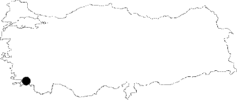 |
For photographs please click on the photo...  |
|
Type:
|
Flat Settlement |
|
Altitude:
|
m |
|
Region:
|
Aegean |
|
Province:
|
Mugla |
|
District:
|
Milas |
|
Village:
|
Damlibogaz |
|
Investigation Method:
|
Excavation |
|
Period:
|
|
|
|
|
 |
|
| It lies where the ancient city of Hydae/Kydae is located; 6 km west-southwest of Milas District; west of Mugla Province. It is very close to Damlibogaz/Damlarbogaz Village in the Saricay Valley joining the Güllük Gulf. The fact that first settlement of the ancient city known to be established in 478 BC is dated back to the third millennium BC can be based upon the recovery of the vessels belonging to the third millennium BC from the antique cemetery revealed after the displacement of the bed of the Saricay River. The cemetery has been plundered by the villagers in the neighborhood since 1970. It was also investigated by the University of Mugla. Intact vessels recovered were collected together by a antiquary; S. Kazancioglu who purchased them and prevented their dispersal. This collection purchased by the Museum of Sadberk Hanim in 2001 includes spouted pitchers; tureens and amphoras. It is certain that the site had been heavily occupied during the EBA like Iassos in this region. During the survey conducted by A. Diler in 2002 the illicit digging pits were investigated and new broken sherds belonging to the damaged pithos were found. This recent information has proven that the EBA ceramics displayed and stored in the Milas Museum actually came from this site. As a result of the ceramic analysis; these finds; according to their material; technique and decoration; have parallels in Iassos; Beycesultan; Aphrodisias; Elmali-Karatas; Efes; Karahisar in Southwestern Anatolia; Liman Tepe; Baklatepe in western Anatolia; Troia; Yortan; Babaköy in northwestern Anatolia; Manisa-Akhisar region in mid-west Anatolia; Kusura; Bozüyük; Küllüoba and Küçükhöyük in central Anatolia as well as Mainland Greece and the Cyclades. During the Bodrum Peninsula Leleg Settlements Survey performed by A. Diler et al. between 2006 and 2007, it was observed that some wall remains and pithoi burials were revealed through illicit diggings in the stream bank. Out of thepithoi which were buried underneath Sariçay Plain approximately at 5-6 m depth and hevily destroyed the measurable, better preserved ones have a diameter approximately of 0.35-0.90 m. The EBA sherds and pithoi that were found, prove that the area 500 m north of the present village settlement was an EBA necropolis for certain [Diler et al. 2009:133-134]. A pithos was found in situ for the first time during the survey by Diler and Gümüs performed in the cemetery area. With a diameter of 0.85 m it is assumed to be used as a burial pithos [Diler-Gümüs 2010:104-105]. It is listed in the registered archaeological preservation zone inventory prepared by Ministry of Culture and Tourism. |
| Location: It is located in the Village of Damlibogaz to the west of the Sodra Mountain; 8 km far from the Milas District of the Mugla Province as the crow flies. It lies between the Kale Tepesi on which the village is situated and the Saricay Valley (ancient name Kybersos) to the east and its vicinity [Diler 2002:225]. |
| Geography and Environment: It is reported that the former bed of Saricay was running up to 40-50 m west of the present channel [Diler 2002:225]. Beyond Saricay; flowing immediately front of the Damlibogaz Village; extends a wide fertile plain. The city was established on a steep; and rocky hill [Tirpan 1999b:461-62]. |
| History: |
| Research and Excavation: |
| Stratigraphy: |
| Small Finds: |
| Remains: |
| Interpretation and Dating: |