|
©The Archaeological Settlements of Turkey - TAY Project
|
|
|
|
|
|
Çöplük Bostani |
|
|
For site maps and drawings please click on the picture...  |
For photographs please click on the photo... 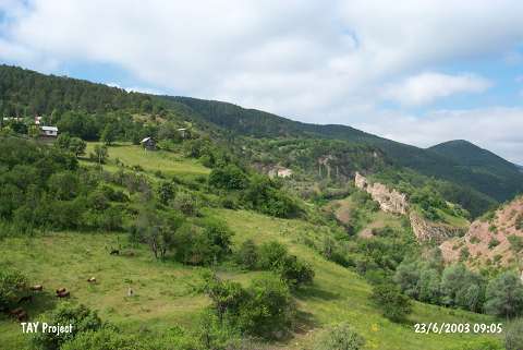 |
|
Type:
|
Mound |
|
Altitude:
|
1070 m |
|
Region:
|
Black Sea |
|
Province:
|
Ordu |
|
District:
|
Mesudiye |
|
Village:
|
Kaleköy |
|
Investigation Method:
|
Survey |
|
Period:
|
|
|
|
|
 |
|
| It is located on a slope reaching to the Saray Stream and reclining under the southeastern walls of a fortress located at Kale Köy; 6 km northeast of Mesudiye District; south of Ordu Province. It was discovered during the 1993 Ordu-Mesudiye survey conducted by M. Özsait. Gray and dark brown colored EBA pottery was collected from the surface. According to M. Özsait; fortress had been erected on a mound. |
| Location: |
| Geography and Environment: |
| History: |
| Research and Excavation: |
| Stratigraphy: |
| Small Finds: |
| Remains: |
| Interpretation and Dating: |