|
©The Archaeological Settlements of Turkey - TAY Project
|
|
|
|
|
|
Çingantepe |
|
|
For site maps and drawings please click on the picture...  |
For photographs please click on the photo... 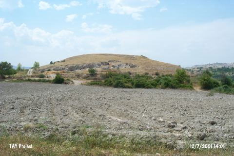 |
|
Type:
|
Mound |
|
Altitude:
|
270 m |
|
Region:
|
Mediterranean |
|
Province:
|
Mersin |
|
District:
|
Mut |
|
Village:
|
Kislaköy |
|
Investigation Method:
|
Survey |
|
Period:
|
|
|
|
|
 |
|
| It lies 1.5 km south of Kislaköy Village; southeast of Mut District of Mersin Province. Northwest of the mound flows the stream of Göksu. It was discovered by D. French and dated to EBA. It takes place in the registered archaeological sites list prepared by Ministry of Culture and Tourism. It was visited during the survey conducted by T.E. Serifoglu in 2013. It was stated that the mound was inhabited from EBA to Middle Age with interruption. The archaeological material shares similarities with the ones found in Kilisetepe that is located on the northern bank of Göksu River [Serifoglu 2015:45]. It will be flooded by the Kayraktepe Dam to be built on the Göksu Valley in Mersin. In 2014, the geophysical scanning studies conducted on the western slope of the mound. As a result of this scanning study, rectangular planned structures determined just below the surface [Serifoglu 2016:267]. |
| Location: |
| Geography and Environment: |
| History: |
| Research and Excavation: |
| Stratigraphy: |
| Small Finds: |
| Remains: |
| Interpretation and Dating: |