|
©The Archaeological Settlements of Turkey - TAY Project
|
|
|
|
|
|
Çigirtkankaya |
|
|
For site maps and drawings please click on the picture... 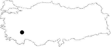 |
For photographs please click on the photo... 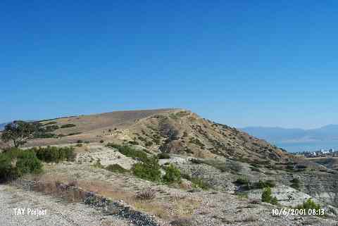 |
|
Type:
|
Flat Settlement |
|
Altitude:
|
970 m |
|
Region:
|
Mediterranean |
|
Province:
|
Burdur |
|
District:
|
Merkez |
|
Village:
|
Suludere |
|
Investigation Method:
|
Survey |
|
Period:
|
Early |
|
|
|
 |
|
| The site is the pasture of Suludere village; 12 km southwest of the city of Burdur. It was discovered during the Survey of the Lake District conducted by M. Özsait in 1972. Potsherds were collected at an area of 600x200 m. Monochrome vessels of buff and red painted surface; thin paste ware dating back to the Early Chalcolithic Age were collected from the surface. The site was also occupied in the Late Antiquity. |
| Location: |
| Geography and Environment: |
| History: |
| Research and Excavation: |
| Stratigraphy: |
| Small Finds: |
| Remains: |
| Interpretation and Dating: |