|
©The Archaeological Settlements of Turkey - TAY Project
|
|
|
|
|
|
Çiftlik Tepe |
|
|
For site maps and drawings please click on the picture...  |
For photographs please click on the photo... 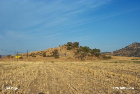 |
|
Type:
|
Mound |
|
Altitude:
|
m |
|
Region:
|
Marmara |
|
Province:
|
Çanakkale |
|
District:
|
Bayramiç |
|
Village:
|
|
|
Investigation Method:
|
Survey |
|
Period:
|
EBA III EBA II |
|
|
|
 |
|
| It lies on the southern bank of the Kara Menderes River; about 3 km east of Bayramiç District; Çanakkale Province. It was discovered by J. Cook in 1967. The site yielded Troy I style black burnished bowls with inrolled rims and a small sherd possibly dating from the EBA III. In addition; MBA and LBA materials were recovered. |
| Location: |
| Geography and Environment: |
| History: |
| Research and Excavation: |
| Stratigraphy: |
| Small Finds: |
| Remains: |
| Interpretation and Dating: |