|
©The Archaeological Settlements of Turkey - TAY Project
|
|
|
|
|
|
Akarçay Höyük |
|
|
For site maps and drawings please click on the picture...  |
For photographs please click on the photo... 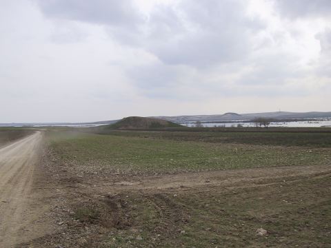 |
|
Type:
|
Mound |
|
Altitude:
|
357 m |
|
Region:
|
Southeastern Anatolia |
|
Province:
|
Sanliurfa |
|
District:
|
Birecik |
|
Village:
|
Akarçay |
|
Investigation Method:
|
Excavation |
|
Period:
|
EBA III |
|
|
|
 |
|
| Location: This site is 900 m Southeast of Akarçay Village that is approximately 15 km South of Birecik Suburb of Sanliurfa City. |
| Geography and Environment: The site is on a terrace which is possibly created in Late Pleistocene Age overlooking Euphrates River Bed and it is 180 m between North and East Edges, and 160 m between East and West. The summit of the mound is 357 m of altitude. Its North slope is steep and other directions are slopped in benches. |
| History: |
| Research and Excavation: Akarçay Mound surveys are carried out in 1998 under the scope of "Recovery Project for the Archaeological and Cultural Artefacts that will Remain Under Ilõsu and Karkamõs Water Reservoirs" led by the coordination of ODTÜ-TAÇDAM. And in 1999 the excavations started. The mound is discovered by G. Algaze. The rescue excavation is initiated in 1999 by a team led by Y. Mergen and A. Deveci. The site is listed in the registered list of archaeological sites created by Ministry of Culture and Tourism. |
| Stratigraphy: During 2002 excavations among the cultures identified in the mound are four phases of Middle Age, Late Roman, Roman; two phased Hellenistic, Middle and Early Bronze Ages. And even though its layers could not be reached it is believed that Chalcolithic Period also exist in the mound based on the analysis of Uruk and Halaf pottery samples captured. |
| Small Finds: Architecture: Five architecture levels are identified during 2002 excavations in Trench I 9a. The Architecture Level I is represented with the pressurized soil base which is partially preserved and located in the East edge of the trench which is unearthed in 2001. The Architecture Level I is represented with the elliptical workshop and a part of a base which is believed to be interlinked and located in the Northeast corner of the trench. The base of the workshop is paved with large stones and about 1.26 m long in the Southwest. A piece of basaltic grinding stone is found in the South of the workshop as well as a basaltic mortar stone located after removal of the workshop. Stone foundation remains that belong to a rectangular planned structure in Architecture Level III. The long side of the structure is constructed in Northeast - Southwest direction and its West wall is destructed by erosion. 1 by 1 m architecture remains made of one row of stones adjacent to the internal side of the South wall of the structure can be a stone pavement belonging to the foundation; or they can be remains of the stone foundation from a later period [Deveci-Ensert 2011: 188-189]. The stone walls which make up the Northwest corner of a structure in Architecture Level IV are in the same direction with the East and North walls of the structure from the Architecture Level III and they remain inside the walls of Architecture Level III. Both walls are made of two rows of stones and mortared with mud. The internal and external sides of this stone wall are constructed with large stones and then filled in between with smaller stones. A room which is used as a wet room is excavated in Architecture Level V, in the East of Stone Walls 11 and 12 from Architecture Level IV. A stone wall exists in the South of this room constructed in Southwest-West and Northeast-East direction. White plastered face of the wet room is adjacent with the North face of this stone wall. This stone wall merges with another wall extending to Northwest creating a corner. The wet room is two-phased. During the first phase its size is 1.80 by 1.30 m -internal measurement. During the second phase it became smaller and its size became 1.30 by 0.90 m -internal measurement. The base from the first phase of the room is only preserved in the East part. Marks of white plaster exist on the internal side of the North wall which is made of two rows of stones and mud mortar. Wall's East part remained under a stone wall from Architecture Level IV. Pressurized soil base which is paved with pebble stones is excavated in the South of Stone Wall 14, on the West side. The base is about 3 cm in thickness and located between the South stone wall of the wet room and the South wall of the trench [Deveci-Ensert 2004: 385]. A terrace embankment with two phases is excavated right under the surface soil and in the East of Trench I 8a. The two-phased terrace embankment is 2.15 m wide in the North and 2.55 m in the South and it is used as an open space for dropping waste. 15 rows of adobe bricks are preserved in the East side of the terrace embankment. Mud mortar and debris are used as the filling materials in the terrace. The terrace embankment is constructed without removing the previous base and it is believed that this has become the base for the architecture in the West of Trench I 9a [Deveci-Ensert 2004: 385-386]. Pottery: In 2002 simple pottery pieces are captured in Architecture Level I Trench 19a. Few simple pottery pieces are found in Architecture Level II and III. Deep grooved, simple, and high fruit-stands are used from EBA I until Early Bronze Age/Middle Bronze Age [Deveci-Ensert 2011: 188-190]. Late Chalcolithic and EBA I-IV pottery pieces are captured in the terrace embankment of Trench I 8a. Curved rimmed bowl pieces from Late Uruk Period found intensely suggest that Akarçay Mound may be one of the Uruk settlements that are settled on the shores of Euphrates River. A painted vessel similar to Ninova 5 is biconic bodied, featuring handles with three string holes, with broken neck and base, red, and geometric decorated. Right against one of the handles with string holes a bulge like another handle or a decoration exists. A non-painted Ninova 5 sample is also captured having this form [Deveci-Ensert 2011: 191]. |
| Remains: |
| Interpretation and Dating: |