|
©The Archaeological Settlements of Turkey - TAY Project
|
|
|
|
|
|
Akarçay Höyük |
|
|
For site maps and drawings please click on the picture...  |
For photographs please click on the photo... 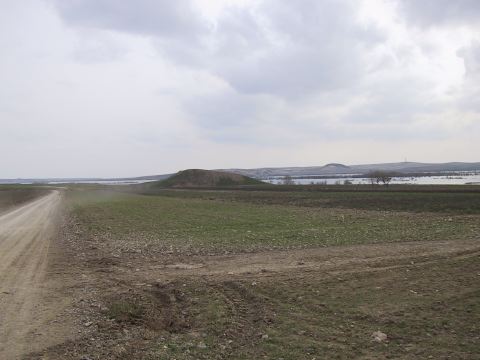 |
|
Type:
|
Mound |
|
Altitude:
|
357 m |
|
Region:
|
Southeastern Anatolia |
|
Province:
|
Sanliurfa |
|
District:
|
Birecik |
|
Village:
|
Akarçay |
|
Investigation Method:
|
Excavation |
|
Period:
|
Late |
|
|
|
 |
|
| The mound lies southwest of Sanliurfa; south of Birecik; on the east bank of Euphrates; 900 meters east-southeast of Akarçay village. The conical mound with terraces measures 18 m height and 180x80 m in size. A systematic surface collection was conducted by a team directed by G. Algaze in 1989. Uruk type of sherds of beveled rim bowls; rim slipped bowls; and grit-tempered dishes were found. Besides Uruk type of sherds; the EBA 3/MBA 1; Hellenistic; Roman and Medieval pottery are found. The mound will probably be inundated by Karkamis Dam. A salvage excavation was started in 1999 under Y. Mergen and A. Deveci. During 2002 season excavations lots of bevelled rim bowls and a single body sherd with incised decoration of triangles and cross hatchings in horizontal bands were found in trench I-8a and dated to Late Uruk Period [Deveci-Ensert 2004:386]. It takes place in the registered archaeological sites list prepared by Ministry of Culture and Tourism. |
| Location: This site is 900 m Southeast of Akarçay Village that is approximately 15 km South of Birecik Suburb of Sanliurfa City. |
| Geography and Environment: The site is on a terrace which is possibly created in Late Pleistocene Age overlooking Euphrates River Bed and it is 180 m between North and East Edges, and 160 m between East and West. The summit of the mound is 357 m of altitude. Its North slope is steep and other directions are slopped in benches. |
| History: |
| Research and Excavation: |
| Stratigraphy: |
| Small Finds: |
| Remains: |
| Interpretation and Dating: |