|
©The Archaeological Settlements of Turkey - TAY Project
|
|
|
|
|
|
Çaylak Degirmen |
|
|
For site maps and drawings please click on the picture...  |
For photographs please click on the photo... 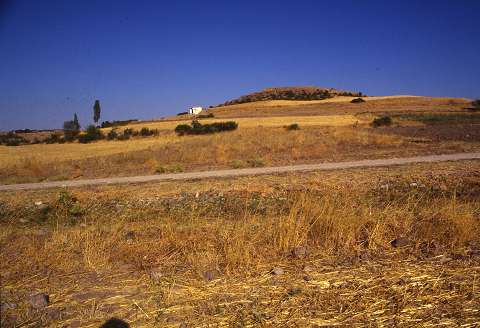 |
|
Type:
|
Mound |
|
Altitude:
|
600 m |
|
Region:
|
Black Sea |
|
Province:
|
Amasya |
|
District:
|
Göynücek |
|
Village:
|
Sihlar |
|
Investigation Method:
|
Survey |
|
Period:
|
|
|
|
|
 |
|
| It stands on a natural hill; west of the Abaci Village exit; 2 km southwest of Sihlar Village; southwest of Amasya Province. It was discovered in 1989 during a survey conducted by M. Özsait. It measures 80x125x8 m. It is located 1 km east of the Çekerek River; next to the former bed of the river. Limited number of EBA pottery was collected from the surface. Their interior surfaces are washed in brown; sometimes gray or black; and exterior surfaces washed in black or red and brown and burnished. It takes place in the registered archaeological sites list prepared by Ministry of Culture and Tourism. |
| Location: |
| Geography and Environment: |
| History: |
| Research and Excavation: |
| Stratigraphy: |
| Small Finds: |
| Remains: |
| Interpretation and Dating: |