|
©The Archaeological Settlements of Turkey - TAY Project
|
|
|
|
|
|
Çavuslu Höyük |
|
|
For site maps and drawings please click on the picture...  |
For photographs please click on the photo... 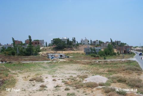 |
|
Type:
|
Mound |
|
Altitude:
|
185 m |
|
Region:
|
Mediterranean |
|
Province:
|
Mersin |
|
District:
|
Merkez |
|
Village:
|
Toroslar |
|
Investigation Method:
|
Excavation |
|
Period:
|
Ceramic |
|
|
|
 |
|
| Location: The site of Çavuslu lies at the 2007 th Street of the municipality Toroslar (Çavuslu); 6 km north-northwest of the city of Mersin. |
| Geography and Environment: The mound lies 5-6 m above a sloping plain; west of Çavuslu Stream. The diameter of the mound has not been provided. It has not been reported whether there is a water source nearby. |
| History: |
| Research and Excavation: Excavations on the mound; which was discovered by B. Brown; were carried out in 1937 under J. Garstang's direction and Neilson's financial support. A total of five trenches were opened. In 1951; Seton-Williams conducted a surface collection on the mound. |
| Stratigraphy: While most of the finds were dated to the second millennium BC (The Hittite Period); a few Roman and Iron Age finds were also collected. |
| Small Finds: Pottery: The excavation director assigns the hand-made; gray; black and brown; dark burnished ware recovered from Trench D to the Late Neolithic and Early Chalcolithic Periods. Chipped Stone: Seton-Williams notes that he collected obsidian and chert scarpers; perforators; blades and cores; all dating to the Late Neolithic and Early Chalcolithic Periods [Garstang 1937:61-61; fig XII]. |
| Remains: |
| Interpretation and Dating: The finds appear to be contemporaneous with Mersin Yumuktepe levels XXVII-XXIV and Amuq B affinities. Because excavation in the 1930's was less careful; neither the stratigraphic sequence nor the earliest level is known. In ASPRO; this site has been assigned to the sixth period (7;600-7;000 BP) [Hours et al. 1994:95]. |