|
©The Archaeological Settlements of Turkey - TAY Project
|
|
|
|
|
|
Çamur Höyük |
|
|
For site maps and drawings please click on the picture...  |
For photographs please click on the photo... 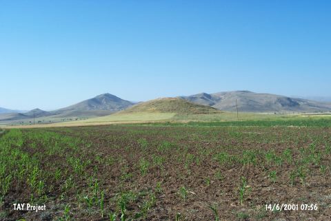 |
|
Type:
|
Mound |
|
Altitude:
|
1160 m |
|
Region:
|
Mediterranean |
|
Province:
|
Burdur |
|
District:
|
Karamanli |
|
Village:
|
Harmankaya |
|
Investigation Method:
|
Survey |
|
Period:
|
Ceramic |
|
|
|
 |
|
| This site lies northwest of Harmankaya Village; approximately 4 km southeast of Karamanli District; southwest of the city of Burdur. The dimensions of this mound; which lies in the Tefenni Plain; are 100x200x10 m. This flat lying mound has undergone a lot of destruction. It was originally discovered by Lloyd and Mellaart but resurveyed by M. Özsait in 1975 and 1981. The pottery collected suggests that there was continuous habitation at the mound from the Neolithic to the end of the first millennium BC. It has been suggested that the thin-walled; high; flaring forms with rounded bodies and pierced lugs are Neolithic in date. These are usually small vessels and cannot be assigned to the Neolithic with certainty. |
| Location: |
| Geography and Environment: |
| History: |
| Research and Excavation: |
| Stratigraphy: |
| Small Finds: |
| Remains: |
| Interpretation and Dating: |